|
July
2005
Where
are we: Kyambura
Gorge, Queen Elizabeth National Park, Uganda
Date: 1st July 2005
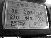
End GPS: S00 11.310
E030 06.078
Total Kilometres: 62170km
Weather: Sunny and warm
Camping: Fig Tree Camp
 We
are now heading north into the heart of Uganda, in search of forest
chimpanzee. Our final destination shall be Budongo forest northwest
of Fort Portal where a group of chimpanzee regularly come to feed on
the mango trees of the nearby village. The route shall lead us through
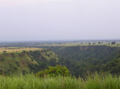
the Queen Elizabeth National park and over the escarpment that fringes
the great Ruwenzori mountains or Mountains of the Moon as they are more
romantically referred too. This is classic Ugandan scenery, lush green
rolling hills and thick forests. Sadly most of the wildlife in the QE
park was wiped out during the Tanzanian / Uganda conflict, but the park
is still scenic and worth a visit especially if you are intending to
visit Muchison falls. We
are now heading north into the heart of Uganda, in search of forest
chimpanzee. Our final destination shall be Budongo forest northwest
of Fort Portal where a group of chimpanzee regularly come to feed on
the mango trees of the nearby village. The route shall lead us through
the Queen Elizabeth National park and over the escarpment that fringes
the great Ruwenzori mountains or Mountains of the Moon as they are more
romantically referred too. This is classic Ugandan scenery, lush green
rolling hills and thick forests. Sadly most of the wildlife in the QE
park was wiped out during the Tanzanian / Uganda conflict, but the park
is still scenic and worth a visit especially if you are intending to
visit Muchison falls.
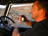
We filled the DuK with diesel
and food and headed toward Mbarara where we would turn north. There
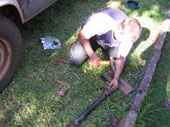
is a shorter route but our steering arm has come loose again and I need
to find a lock washer and a socket large enough to fit the oversize
nut, It's a Land Rover !!!!
We wobbled our way to the town,
avoiding the kamakazee buss drivers who drive blind on our side of the
road making us swerve off the road to avoid a head on, no luck on finding
the socket or lock washer so we made some temporary repairs and headed
north.
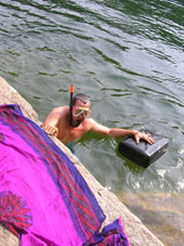
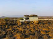
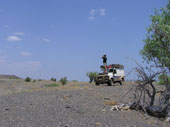
We reached the QE park just in
time for sunset, driving off the tar road for 2 km we came upon Fig
Tree camp, a lovely camp set above the Kyamburu gorge. We looked for
someone to sign in with and ask the price of camping but the place was
deserted. Oh well they would obviously come in the morning and we would
have to hope that the charge for camping was acceptable............they
never came!!! we never paid and so we had a free bushcamp. The view
into the gorge is wonderful and made a fine backdrop as the red fireball
sun set in the west.
We enjoyed an enjoyable night,
Kat cooked a very nice beef stir fry with noodles in the pokje and we
had a tipple of whisky to enjoy the nights sky star gazing, soon we
shall have a new heavenly body over us as the southern cross and hemisphere
constellations give way to the more familiar polar star and northern
heavens. A very peaceful evening.
Tagebuch
Es war ein wunderschoener klarer
Morgen und somit sind wir guter Stimmung weiter in den Norden Uganda's
gefahren um uns auf die Suche auf Schimpanzen zu machen. Unsere Gemuesefrau
hat uns noch eine Papaya geschenkt und spaeter in Mbarara angehalten
und eine passende Nuss fuer unseren Lenkungsarm zu suchen. Die Lenkung
wackelt schon wieder ohne Ende und keiner hat die grosse Nuss! Die Ugander
sind die schlimmsten und schnellsten Fahrer bisher in Afrika (ausser
vielleicht Nigeria) und da macht das mit einer wobbeligen Lenkung nicht
so viel Spass...
 Es
war schon ziemlich spaet und wir wussten nicht wo wir anhalten sollten,
sind weiter zum Queen Elizabeth Park gefahren, wo man einfach so durchfahren
kann und Kobs sieht und bei Glueck Elephanten. Die Daemmerung fiel und
wir konnten kein bushcamp finden. Dann sind wir zur Kyambara Gorge gefahren
und ein Schild zum Fig Tree Camp gefolgt. Als wir dort ankamen auf 2-3
km schoener Piste durch's hohe Gras, wurden wir erstmal von bellenden
Kobs (Antilopen) empfangen. Die sind so suess und schuechtern, waren
aber ganz mutig und neugierig und haben uns beobachtet.... Es gab eine
Schranke und wir haben die Rezeption gesucht. Alles war abgeschlossen
und keiner war da. Wir haben immer wieder gerufen und uns auf Spurensuche
gemacht, aber keine Menschenseele gefunden. Da die Sonne gerade unterging
haben wir uns beschlossen einfach hier zu campen und dann am Morgen
mit jemanden den Preis besprechen. Gerade als wir Tee machen wollten
ging uns das Gas aus uns somit haben wir mit dem Kelly Kettle Tee aufgebrueht
und zum Glueck noch mit ein paar Kohlen unser Abendessen im Pojke gekocht.
Es war echt schoen hier und so ruhig, doch leider haben wir keine Elephanten
gesehen. Nach dem obligatorischen Sternegucken sind wir dann frueh ins
Bett gegangen. Es
war schon ziemlich spaet und wir wussten nicht wo wir anhalten sollten,
sind weiter zum Queen Elizabeth Park gefahren, wo man einfach so durchfahren
kann und Kobs sieht und bei Glueck Elephanten. Die Daemmerung fiel und
wir konnten kein bushcamp finden. Dann sind wir zur Kyambara Gorge gefahren
und ein Schild zum Fig Tree Camp gefolgt. Als wir dort ankamen auf 2-3
km schoener Piste durch's hohe Gras, wurden wir erstmal von bellenden
Kobs (Antilopen) empfangen. Die sind so suess und schuechtern, waren
aber ganz mutig und neugierig und haben uns beobachtet.... Es gab eine
Schranke und wir haben die Rezeption gesucht. Alles war abgeschlossen
und keiner war da. Wir haben immer wieder gerufen und uns auf Spurensuche
gemacht, aber keine Menschenseele gefunden. Da die Sonne gerade unterging
haben wir uns beschlossen einfach hier zu campen und dann am Morgen
mit jemanden den Preis besprechen. Gerade als wir Tee machen wollten
ging uns das Gas aus uns somit haben wir mit dem Kelly Kettle Tee aufgebrueht
und zum Glueck noch mit ein paar Kohlen unser Abendessen im Pojke gekocht.
Es war echt schoen hier und so ruhig, doch leider haben wir keine Elephanten
gesehen. Nach dem obligatorischen Sternegucken sind wir dann frueh ins
Bett gegangen.
Where are
we: Lake
Nkurugu, Uganda
Date: 2nd - 3rd July
2005
End GPS: N00 31.109
E030 18.140
Total Kilometres: 62,424km
Weather: Hot and humid
Camping: Lake Nkurugu Camp
  The
route north is a mix of tar and maram surfaces in varying states of
repair. The maram road was in a poor state and our speed dropped dramatically
to avoid the potholes and rocks. The weather is threatening again and
we are concerned that if it rains we shall yet again have no grip on
the slippery surface. Hopefully we shall cross the equator today, this
is our forth and probably last time of crossing the great circle. Enroute
we saw buffalo, kob, and waterbuck. We arrived in Fort Portal early
and made straight for the Ruwenzori Hotel where we enjoyed a fine breakfast
before we embarked on a day trip to the DRC border. Yvonne and Remo
had told us that the drive was very scenic with sweeping vistas of the
rainforest......haven't we seen enough of that stuff? Guess not. The
drive was indeed scenic and reminiscent of being back in the Congo.
We climbed and descended switch backs that gave us lovely views over
the thick canopy of Parc National De Virunga rainforest below us. We
had hoped to go to some hot springs near Bundibugyo in the Semuliki
National Park, alas they wanted over $30US just for a 2 hour visit.........still
we did make a quick drive into the park, unofficially and got to see
quite a few pygmies. The
route north is a mix of tar and maram surfaces in varying states of
repair. The maram road was in a poor state and our speed dropped dramatically
to avoid the potholes and rocks. The weather is threatening again and
we are concerned that if it rains we shall yet again have no grip on
the slippery surface. Hopefully we shall cross the equator today, this
is our forth and probably last time of crossing the great circle. Enroute
we saw buffalo, kob, and waterbuck. We arrived in Fort Portal early
and made straight for the Ruwenzori Hotel where we enjoyed a fine breakfast
before we embarked on a day trip to the DRC border. Yvonne and Remo
had told us that the drive was very scenic with sweeping vistas of the
rainforest......haven't we seen enough of that stuff? Guess not. The
drive was indeed scenic and reminiscent of being back in the Congo.
We climbed and descended switch backs that gave us lovely views over
the thick canopy of Parc National De Virunga rainforest below us. We
had hoped to go to some hot springs near Bundibugyo in the Semuliki
National Park, alas they wanted over $30US just for a 2 hour visit.........still
we did make a quick drive into the park, unofficially and got to see
quite a few pygmies.
We drove back to the outskirts
of Fort Portal and then diverted off toward Lake Nkurugu, an extinct
volcanic crater that over the years filled with water that now is bright
green. The lake is safe to swim in and so we indulged ourselves, although
it was a trifle "squary" as the bubbles rose from out of the
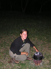
murky green deep water.....The camp here is very nice and friendly and
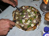
Kat and I set about making Pizza in the Potje......a great success except
that we ate by far to much and felt totally bloated after our over indulgence.
In fact we had so much dough left that we made a loaf of bread from
it.
It was so relaxing here we decided
to stay for an additional day.
Tagebuch
  Als
wir morgens schon frueh aufwachten hatten wir einen schoenen Sonnenaufgang
ueber die Gorge und Savannah und es war immer noch keiner da. Nachdem
wir einen Tee gemacht haben sind wir dann einfach losgefahren. Cool
so ein camp zu finden und umsonst dort zu schlafen! Um 8:00 Uhr gings
los und die Strasse fuehrte direkt an der Kongo (DRC) Grenze vorbei,
wo wir uns vor fast einem Jahr befanden, und wieder einmal haben wir
den Aequator ueberquert. Als wir in Fort Portal ankamen haben wir Kerosin
gekauft un dann erstmal im Rwenzori Guesthouse schoen gefruehstueckt.
Von hier wollten wir nur zum Lake Nkurugu, einem Kratersee, angeblich
200 m tief. Da der nur 9 km weiter weg ist haben wir uns beschlossen
zu den Hot Springs in Bundibugyo an der Kongo Grenze zu fahren. Die
Fahrt war wunderschoen mit Aussicht auf die Rwenzori Mountains und spaeter
den Parc National de Virunga im Kongo, wo es auch noch Gorillas gibt.
Leider war es mal wieder so diesig dass man keine gute Photos machen
konnte... Als
wir morgens schon frueh aufwachten hatten wir einen schoenen Sonnenaufgang
ueber die Gorge und Savannah und es war immer noch keiner da. Nachdem
wir einen Tee gemacht haben sind wir dann einfach losgefahren. Cool
so ein camp zu finden und umsonst dort zu schlafen! Um 8:00 Uhr gings
los und die Strasse fuehrte direkt an der Kongo (DRC) Grenze vorbei,
wo wir uns vor fast einem Jahr befanden, und wieder einmal haben wir
den Aequator ueberquert. Als wir in Fort Portal ankamen haben wir Kerosin
gekauft un dann erstmal im Rwenzori Guesthouse schoen gefruehstueckt.
Von hier wollten wir nur zum Lake Nkurugu, einem Kratersee, angeblich
200 m tief. Da der nur 9 km weiter weg ist haben wir uns beschlossen
zu den Hot Springs in Bundibugyo an der Kongo Grenze zu fahren. Die
Fahrt war wunderschoen mit Aussicht auf die Rwenzori Mountains und spaeter
den Parc National de Virunga im Kongo, wo es auch noch Gorillas gibt.
Leider war es mal wieder so diesig dass man keine gute Photos machen
konnte...
 Bei
den Hot Springs sind uns dann auch wieder ein paar Pygmaenen entgegen
gekommen, die in diesen Bei
den Hot Springs sind uns dann auch wieder ein paar Pygmaenen entgegen
gekommen, die in diesen 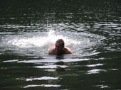 Regenwaeldern
leben und sich selbst versorgen. Fuer die Hot Springs sollten wir 30US$
Eintritt bezahlen, nur um dort eine halbe Stunde rumzulaufen!! Also
haben wir das nicht gemacht und sind wieder zurueckgefahren. In Fort
Portal mussten wir Holzkohle kaufen und die Damen wollten mich alle
verarschen und haben mir immer nur den Mzungu-Preis genannt. Ich wurde
dann sauer und habe gar keine gekauft. Als wir beim Nkurugu See ankamen
konnten wir dort campen und haben Holz eingesammelt um zu kochen und
Tee zu machen. Der See war ziemlich klein aber sehr ruhig und entspannend
und das Wasser eiskalt! Regenwaeldern
leben und sich selbst versorgen. Fuer die Hot Springs sollten wir 30US$
Eintritt bezahlen, nur um dort eine halbe Stunde rumzulaufen!! Also
haben wir das nicht gemacht und sind wieder zurueckgefahren. In Fort
Portal mussten wir Holzkohle kaufen und die Damen wollten mich alle
verarschen und haben mir immer nur den Mzungu-Preis genannt. Ich wurde
dann sauer und habe gar keine gekauft. Als wir beim Nkurugu See ankamen
konnten wir dort campen und haben Holz eingesammelt um zu kochen und
Tee zu machen. Der See war ziemlich klein aber sehr ruhig und entspannend
und das Wasser eiskalt!
Wir sind noch am naechsten Tag
geblieben und mit einem leeren Wasserkanister im See gepaddelt. Spaeter
haben wir ganz lecker auf Kohle Pizzas gemacht.
Where are
we: Budongo
Forest, Uganda
Date: 4th - 5th July
2005
End GPS: N01 42.928
E031 28.170
Total Kilometres: 62, 699km
Weather: Humid
Camping: Busingiro Eco
Camp
 An
easy day of driving to the eco camp at Budungo Forest where we are hope
to see chimps in their natural habitat. Indeed, as we set up and enjoyed
a cup of tea we heard the screams and commotion of the chimps somewhere
in the village, where they come to eat the mango fruits in the evening.
Kat and I decided to head out to see if we could get a sighting but
alas we caught but only a glimpse of a chimps ass as he scampered out
of the tree upon hearing our approach. Still not to worry as we shall
go on a trek through the forest in the morning. An
easy day of driving to the eco camp at Budungo Forest where we are hope
to see chimps in their natural habitat. Indeed, as we set up and enjoyed
a cup of tea we heard the screams and commotion of the chimps somewhere
in the village, where they come to eat the mango fruits in the evening.
Kat and I decided to head out to see if we could get a sighting but
alas we caught but only a glimpse of a chimps ass as he scampered out
of the tree upon hearing our approach. Still not to worry as we shall
go on a trek through the forest in the morning.
It's a good set up they have here.
If we were to go chimp trekking in Kibale NP, it alone would cost us
$70US each plus then camping. Here at Budungo it cost a mere $15US per
person and that includes camping......cooool
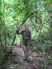
 So
next morning we doned our walking gear, packed our packs and armed ourselves
with tourist "oozie" 35mm's, and set off into the "Heart
of Darkness" ready for our encounter with the chimps. The chimps
had a different idea however and seemed to play with us by calling and
screeching from all around, yet they remained aloof and invisible to
us. They sounded so close but always out of sight and then suddenly
we saw one high in the canopy of the trees. Not to pleased to see us
is all I could gather as the chimp got extremely upset by our presence
and screeched and thrashed about in the tree and then stopped dead and
stared us out. We took as best photos we could of a chimp high in a
tree with the sunlight behind, but hey at least we saw the guy. After
that the chimps played with us by calling and leading us deeper into
the forest. The stupid white ape was only to happy to lumber along after
them. We never saw them for the rest of the morning, but the walk through
the forest was fun and our guide made it educational and interesting.
Its a far cry from the great mountain apes who were only to happy to
have us come right into their home, the chimps are much more aloof and
protective of their territory. Strange as we had expected it to be the
other way round. So
next morning we doned our walking gear, packed our packs and armed ourselves
with tourist "oozie" 35mm's, and set off into the "Heart
of Darkness" ready for our encounter with the chimps. The chimps
had a different idea however and seemed to play with us by calling and
screeching from all around, yet they remained aloof and invisible to
us. They sounded so close but always out of sight and then suddenly
we saw one high in the canopy of the trees. Not to pleased to see us
is all I could gather as the chimp got extremely upset by our presence
and screeched and thrashed about in the tree and then stopped dead and
stared us out. We took as best photos we could of a chimp high in a
tree with the sunlight behind, but hey at least we saw the guy. After
that the chimps played with us by calling and leading us deeper into
the forest. The stupid white ape was only to happy to lumber along after
them. We never saw them for the rest of the morning, but the walk through
the forest was fun and our guide made it educational and interesting.
Its a far cry from the great mountain apes who were only to happy to
have us come right into their home, the chimps are much more aloof and
protective of their territory. Strange as we had expected it to be the
other way round.
We later returned to the village
in the hope of seeing the chimps cross the road to the mango trees and
indeed we were able to spy a couple cross over before they vanished
into the thick grasses. OK it wasn't the best sightings in the world
of chimps but it was their habitat and any sighting of them here is
better then none. We were extremely pleased that at least here man and
ape are living in happy proximity to each other.
Tagebuch
 Heute
ging's weiter und nachdem David diesmal boese wurde mit den Kohleverkaeufern
hab ich dann doch noch welche fuer einen normalen Preis auf dem Markt
von einer anderen Dame bekommen! Die Strasse noerdlich war nicht so
toll und wir sind den ganzen Tag gefahren bis wir um 15:50 Uhr im Budonga
Forest Reserve im Busingiro Camp ankamen. Hier war es sehr schattig
aber angenehm und wieder so ruhig. Wir haben sofort Camp aufgeschlagen
und sind dann zu Fuss in die kleine Siedlung gelaufen, da Remo und Yvonne
uns einen Tipp gaben dass die Schimpanzen dort immer aus dem Regenwald
kommen und beim Dorf die Mangos klauen. Wir haben uns dann bei jemanden
vor 's Feld gesetzt und gewartet....Wie das immer so ist hatten wir
natuerlich kein Glueck und sind etwas enttaeuscht zurueckgegangen um
zu Abend zu essen. Heute
ging's weiter und nachdem David diesmal boese wurde mit den Kohleverkaeufern
hab ich dann doch noch welche fuer einen normalen Preis auf dem Markt
von einer anderen Dame bekommen! Die Strasse noerdlich war nicht so
toll und wir sind den ganzen Tag gefahren bis wir um 15:50 Uhr im Budonga
Forest Reserve im Busingiro Camp ankamen. Hier war es sehr schattig
aber angenehm und wieder so ruhig. Wir haben sofort Camp aufgeschlagen
und sind dann zu Fuss in die kleine Siedlung gelaufen, da Remo und Yvonne
uns einen Tipp gaben dass die Schimpanzen dort immer aus dem Regenwald
kommen und beim Dorf die Mangos klauen. Wir haben uns dann bei jemanden
vor 's Feld gesetzt und gewartet....Wie das immer so ist hatten wir
natuerlich kein Glueck und sind etwas enttaeuscht zurueckgegangen um
zu Abend zu essen.
Als wir gerade Tee gekocht haben,
haben wir ploetzlich ein riesen Theater, Geschreie und Gekreische gehoert
und waren uns sicher das waren die Schimpanzen! Wir haben alles stehen
und liegen gelassen und sind wieder losgelaufen, haben einen Guide getroffen,
der mit uns dann durch alle Hintergaerten bei dem Haeusern vorbei zu
den Mangobaeumen gefuehrt hat. Es war schon Daemmerung und nach ein
paar Minuten haben wir endlich welche in den Baeumen gesehen! Einige
sind abgehauen und eine sehr laute Schimpanzin hat sich oben in einer
Baumgabel versteckt und runtergeschimpft. Das war cool und sehr aufregend!
Danach sind wir zurueck zum Camp haben noch mehr Tee getrunken und sind
mit Vorfreude auf den morgigen Trek im Regenwald ins Bett gegangen.
Um 6:00 Uhr sind wir aufgestanden
und es war noch sehr kuehl und dunkel. Schnell haben wir Kaffee und
Brote gemacht und sind dann schon um 6:30 Uhr losgelaufen. Unser Tracker,
Vincenz, war sehr nett und suess. Ein aelterer Mann der die Schimpanzen
wirklich mag und sich mit ihren Spuren auskennt. Hier in Budonga Forest
Reserve kann man fuer 7Euro campen und gleichzeitig den Trek machen
(alles inbegriffen). Somit ist dies die billigste Option in Uganda Schimps
zu sehen, aber auch nicht garantiert, dass man sie sieht, da sie ja
wild sind und hier nicht habituiert werden...
  Gleich
als wir wieder bei der Siedlung ankamen sahen wir 2 Schimpanzen ueber
die Strasse laufen, cheeky monkeys! Dann sind wir erstmal zu den Mangobaeumen
aber da waren sie schon wieder weg. Also hat Vincenz uns durch den dichten
Regenwald (arghhh, nicht gerade mein liebster Platz auf der Erde!!)
gefuehrt und mit seiner Machette den Weg frei gemacht. Nach ca. einer
Stunde konnten wir sie wieder kreischen hoeren und waren ploetzlich
ganz nah. Es war so dunkel hier drin dass wir sie erst sehen konnten
als wir ziemlich dicht dranwaren. Wieder die laute Schimpdame die diesmal
ganz hoch oben auf einer Baumkrone sass und gemeckert hat wie ein altes
Fischweib! Die Photos sind leider nichts geworden, aber dafuer eine
kleine Videoaufzeichnung mit dem Geschrei! Die Schimpanzen sind total
anders als die Gorillas und gerne oben auf den Baeumen und bewegen sich
viel mehr. Obwohl wir danach noch weiter den Geraeuschen gefolgt sind
und immer tiefer in den Regenwald haben wir sie nur noch hoeren koennen,
aber nicht mehr gesehen. Schade, aber so sollte es ja auch eigentlich
sein mit wilden Tieren! Am Spaetnachmittag sind wir wieder zu dem Weg
gegangen wo sie immer rauskommen und haben uns an Strassenrand gesetzt
und gewartet. Leider war heute viel Betrieb, Frauen kamen aus dem Wald
mit Feuerholz, Kinder auf Fahrraedern und einige betrunkene Maenner
sind rumgelaufen mit Transitorradio auf der Schulter. Gerade wollten
wir gehen, da hab ich ein Gesicht aus den Straeuchern gucken gesehen.
Als ich die Kamera endlich anhatte war es schon wieder weg....Dann ist
noch einer ueber die Strasse gelaufen und gleich wieder zurueckgelaufen
da einfach zu viele Menschen unterwegs waren. Wir sind dann zurueck
zum Camp, haben Abend gegessen und die Schimpanzen diese Nacht auch
nicht gehoert.....Trotzdem ein tolles Erlebnis!! Gleich
als wir wieder bei der Siedlung ankamen sahen wir 2 Schimpanzen ueber
die Strasse laufen, cheeky monkeys! Dann sind wir erstmal zu den Mangobaeumen
aber da waren sie schon wieder weg. Also hat Vincenz uns durch den dichten
Regenwald (arghhh, nicht gerade mein liebster Platz auf der Erde!!)
gefuehrt und mit seiner Machette den Weg frei gemacht. Nach ca. einer
Stunde konnten wir sie wieder kreischen hoeren und waren ploetzlich
ganz nah. Es war so dunkel hier drin dass wir sie erst sehen konnten
als wir ziemlich dicht dranwaren. Wieder die laute Schimpdame die diesmal
ganz hoch oben auf einer Baumkrone sass und gemeckert hat wie ein altes
Fischweib! Die Photos sind leider nichts geworden, aber dafuer eine
kleine Videoaufzeichnung mit dem Geschrei! Die Schimpanzen sind total
anders als die Gorillas und gerne oben auf den Baeumen und bewegen sich
viel mehr. Obwohl wir danach noch weiter den Geraeuschen gefolgt sind
und immer tiefer in den Regenwald haben wir sie nur noch hoeren koennen,
aber nicht mehr gesehen. Schade, aber so sollte es ja auch eigentlich
sein mit wilden Tieren! Am Spaetnachmittag sind wir wieder zu dem Weg
gegangen wo sie immer rauskommen und haben uns an Strassenrand gesetzt
und gewartet. Leider war heute viel Betrieb, Frauen kamen aus dem Wald
mit Feuerholz, Kinder auf Fahrraedern und einige betrunkene Maenner
sind rumgelaufen mit Transitorradio auf der Schulter. Gerade wollten
wir gehen, da hab ich ein Gesicht aus den Straeuchern gucken gesehen.
Als ich die Kamera endlich anhatte war es schon wieder weg....Dann ist
noch einer ueber die Strasse gelaufen und gleich wieder zurueckgelaufen
da einfach zu viele Menschen unterwegs waren. Wir sind dann zurueck
zum Camp, haben Abend gegessen und die Schimpanzen diese Nacht auch
nicht gehoert.....Trotzdem ein tolles Erlebnis!!
Where are
we: Kampala,
Uganda
Date: 6th -11th July
2005
Total Kilometres: 62, 900 km
Weather: Humid, Rain
and Sunshine
Camping: Backpackers
Red Chilli Hideaway
We have headed back to Kampala
on our way back to Kenya. We have things to do here and shall spend
a few days trying to get gas and do a few repairs and maintenance on
the DuK and ourselves. Kampala is a frustrating city as it is so difficult
to get things done, in effect we have been here nearly a week and achieved
virtually nothing. Kampala is certainly my least favourite city in Africa.
Tagebuch
Wir haben ausgeschlafen, schoen
gefruehstueckt und sind dann wieder nach Kampala gefahren. Hier muessen
wir einige Tage bleiben und Sachen erledigen bevor es weiter wieder
nach Kenya geht. Diese Stadt ist verrueckt und hat uns tierisch angenervt
nach ein paar Tagen, da man nichts auf die Reihe kriegt hier, irgendwie
merkwuerdig.....Es war unmoeglich und unverstaendlich wieso, aber wir
konnten einfach kein Gas hier bekommen!! Irgendwann haben wir aufgegeben
und die Stadt hinter uns gelassen.
Where are
we: Jinga,
Uganda
Date: 12th - 14th
July 2005
Total Kilometres: 63, 167 km
Weather: Hot and Sunny
Camping: Helmut's House
 We
have stopped in Jinga to visit Helmut whom we met in Bwindi and who
invited us to go and stay at his place. Helmut is a great Bavarian who
still wears his Ledehosen in the evenings....them crazy Bavarians!!!.
Still we can't hold a bit of leather against a man, well I would rather
not that is, I can't speak for Kat...... We
have stopped in Jinga to visit Helmut whom we met in Bwindi and who
invited us to go and stay at his place. Helmut is a great Bavarian who
still wears his Ledehosen in the evenings....them crazy Bavarians!!!.
Still we can't hold a bit of leather against a man, well I would rather
not that is, I can't speak for Kat......
Thanks Helmut for a great few
days of rest & relaxation at your place. Hope the renovations are
going well!!!! and all the best for the tours. See you again sometime!!!
Oh and if your wondering what
the photo is, I'am changing yet another spider on the front prop.
Tagebuch
Wir sind das kurze Stueck nach
Jinja gefahren, wo wir Helmut besucht haben. David hat Helmut in Bwindi
kennengelernt, waehrend ich Gorilla gucken war. Helmut kommt aus Muenchen
und lebt in Jinja und hat seine eigene Safarifirma und hat uns koestlich
bekocht und sehr lieb betreut als wir bei ihm waren. Wir haben es uns
gut gehen lassen und hatten viel Spass mit dem Bayern :) Vielen tausend
Dank noch mal! Wir kommen wieder!
Where are
we: Eldoret,
Kenya
Date: 15th - 16th
July 2005
End GPS: N00 26 .862
E35 25.327
Total Kilometres: 63, 459 km
Weather: Hot and sunny
but cold at night
Camping: New Overland
Stop
 We
are trying to make some progress now and get some kilometres under our
feet. We are quite behind schedule for meeting up with Remo and Yvonne
in Lloyangalani on Lake Turkana. The driving is swift on good old black
top and we have arrived in Eldoret enroute to Lake Baringo. We are staying
at the NEW Overland Stop camp that is owned by the legendary mad man
himself, Raj!! What a guy and what a place. Once again I must say many
many thanks for completely OTT hospitality. The whisky never stopped
flowing and Raj showed us around his textile factory and then took us
for a great traditional Indian lunch. Thanks man it was a great time
spent with you, good luck with the new camp, here's wishing you many
many good parties there. We'll always be remembered by the door stop!! We
are trying to make some progress now and get some kilometres under our
feet. We are quite behind schedule for meeting up with Remo and Yvonne
in Lloyangalani on Lake Turkana. The driving is swift on good old black
top and we have arrived in Eldoret enroute to Lake Baringo. We are staying
at the NEW Overland Stop camp that is owned by the legendary mad man
himself, Raj!! What a guy and what a place. Once again I must say many
many thanks for completely OTT hospitality. The whisky never stopped
flowing and Raj showed us around his textile factory and then took us
for a great traditional Indian lunch. Thanks man it was a great time
spent with you, good luck with the new camp, here's wishing you many
many good parties there. We'll always be remembered by the door stop!!

The only thing
Toyota are good at making.....
Tagebuch
  Wir
haben uns von Helmut verabschiedet und sind schnell auf guter Strasse
vorangekommen. Die Grenzueberquerung verlief gut und zuegig und somit
sind wir um 17:00 Uhr in Eldoret, Kenya, angekommen. Hier haben wir
das neue Overland Camp von Raj, einem verueckten Inder, gefunden und
mussten dann auch gleich mit Raj Bier trinken wobei er uns ganz stolz
ueber sein neues Camp gefuehrt hat. Am naechsten Tag sind wir nach Eldoret
gefahren und haben bei der Kaesefabrik 2 kg Kaese ! fuer nur 7 US$ gekauft,
hmm lecker! Danach haben wir uns mit Raj bei seiner Textilfabrik getroffen
und wurden unter die Fittiche genommen. Erst wurde uns die gesamte Fabrik
und Maschinen gezeigt, dann sind wir zu einem Indischen Maennerclub
gefahren, wo wir ganz leckeres Curry gegessen haben, dann zum Obstmarkt,
zum Eisessen und dann wieder zurueck zu unserem Landy, der frisch gewaschen
wie nagelneu auf dem Parkplatz stand! Was fuer eine Gastfreundschaft! Wir
haben uns von Helmut verabschiedet und sind schnell auf guter Strasse
vorangekommen. Die Grenzueberquerung verlief gut und zuegig und somit
sind wir um 17:00 Uhr in Eldoret, Kenya, angekommen. Hier haben wir
das neue Overland Camp von Raj, einem verueckten Inder, gefunden und
mussten dann auch gleich mit Raj Bier trinken wobei er uns ganz stolz
ueber sein neues Camp gefuehrt hat. Am naechsten Tag sind wir nach Eldoret
gefahren und haben bei der Kaesefabrik 2 kg Kaese ! fuer nur 7 US$ gekauft,
hmm lecker! Danach haben wir uns mit Raj bei seiner Textilfabrik getroffen
und wurden unter die Fittiche genommen. Erst wurde uns die gesamte Fabrik
und Maschinen gezeigt, dann sind wir zu einem Indischen Maennerclub
gefahren, wo wir ganz leckeres Curry gegessen haben, dann zum Obstmarkt,
zum Eisessen und dann wieder zurueck zu unserem Landy, der frisch gewaschen
wie nagelneu auf dem Parkplatz stand! Was fuer eine Gastfreundschaft!
Where are
we: Lake
Baringo, Kenya
Date: 17th July 2005
End GPS: N00 36.749
E036 01.445
Total Kilometres: 63, 676km
Weather: Hot, hot and
hotter
Camping: Robert's Camp
 A
beautiful drive today up and over the escarpment and over passes leading
us back across the Rift valley. The scenery is stunning and we are just
cruising enjoying the sun and fresh air and little traffic. Awesome!
Then we descended and the scenery changed dramatically from the sheer
rock cliffs and lush green hills to sand and dusty rock strewn desert.
It feels and smells like coming into Namibia again. We shall overnight
here at Roberts camp that nestles in the reeds of Lake Baringo. This
is a birders paradise and indeed we were greeted by some very forward
birdies who immediately seized the DuK as theirs and set about pecking
or nesting on her roof. This is a beautiful setting and it is a shame
we cannot stay a few days to enjoy the warm air and relaxed atmosphere
here. A
beautiful drive today up and over the escarpment and over passes leading
us back across the Rift valley. The scenery is stunning and we are just
cruising enjoying the sun and fresh air and little traffic. Awesome!
Then we descended and the scenery changed dramatically from the sheer
rock cliffs and lush green hills to sand and dusty rock strewn desert.
It feels and smells like coming into Namibia again. We shall overnight
here at Roberts camp that nestles in the reeds of Lake Baringo. This
is a birders paradise and indeed we were greeted by some very forward
birdies who immediately seized the DuK as theirs and set about pecking
or nesting on her roof. This is a beautiful setting and it is a shame
we cannot stay a few days to enjoy the warm air and relaxed atmosphere
here.
 We
are certainly enjoying rather nice dinners at the moment, The potjke
is in full use every night cooking us lovely stews of fillet steak,
with mushrooms or carrot and potato. Kat has become a dab hand at the
South African art and we are lucky to have plenty of mouth watering
fillet steak onboard the DuK. Where else in the world can you buy a
kilo of prime succulent fillet beef for $3US..........Carnivore, you
bet I am!!!! We
are certainly enjoying rather nice dinners at the moment, The potjke
is in full use every night cooking us lovely stews of fillet steak,
with mushrooms or carrot and potato. Kat has become a dab hand at the
South African art and we are lucky to have plenty of mouth watering
fillet steak onboard the DuK. Where else in the world can you buy a
kilo of prime succulent fillet beef for $3US..........Carnivore, you
bet I am!!!!
We retired to bed early as we
heard the storm coming, feeling the all to familiar buffeting as its
windy hands fingered and probed the camp. Luckily we were well fed and
watered and retired to bed listening to Harry Potter on MP3 before the
storm hit. Alas others in the camp did not fair so well as the downpour
put a damper on their BBQs.
Tagebuch
 Hier
oben war es ziemlich frisch und kuehl und wir haben nachts gefroren.
Nachdem wir uns von Raj verabschiedet haben ging die Strasse durch schoene
huegelige Landschaft ueber einige Paesse, aber wie immer war die Sicht
nicht gut und somit nicht gut zum Photographieren. Wir sind ueber 2000
m gefahren und es war tierisch windig. Nachdem wir durch Kabernet (wie
der Wein nur mit K) kamen wurde die Landschaft ploetzlich mehr Savannenaehnlich,
buschig und heiss, fast wie in Namibia. Hier
oben war es ziemlich frisch und kuehl und wir haben nachts gefroren.
Nachdem wir uns von Raj verabschiedet haben ging die Strasse durch schoene
huegelige Landschaft ueber einige Paesse, aber wie immer war die Sicht
nicht gut und somit nicht gut zum Photographieren. Wir sind ueber 2000
m gefahren und es war tierisch windig. Nachdem wir durch Kabernet (wie
der Wein nur mit K) kamen wurde die Landschaft ploetzlich mehr Savannenaehnlich,
buschig und heiss, fast wie in Namibia.
In Lake Baringo haben wir beim
Roberts Camp angehalten und auch gleich Hippos gesehen. Wir haben unser
DuK unter Akazienbaeume (nicht sehr clever wegen Reifen!) im Schatten
abgestellt, mit guten Blick auf den rosafarbigen See. Das Camp war ganz
cool und wir haben frueh die Kohlen heiss gemacht, den Pojke raufgestellt
und sind ein bisschen auf Entdeckungsreise gegangen. Hier lebt eine
riesige Schildkroete, 65 Jahre alt und total suess. Sie hat meine Tomatenreste
geliebt und mein Nackenkraueln auch. Dann haben wir uns auf den Bootsteg
gesetzt und die Hippos und Krokodile bei einem Bier, beim Sonnenuntergang
beobachtet. Sehr romantisch und schoen! Wir sind frueh ins Bett gegangen
da wir schon den Sturm hoeren konnten und haben uns mit Harry Potter
MP3 im Zelt verkrochen waehrend die anderen Gaeste ihr Abendessen wohl
mit ins Zelt nehmen mussten nachdem die Wolken sich oeffneten....
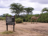
Where are
we: Maralal,
Kenya
Date: 18th -19th
July 2005
End GPS: N01 03.511
E036 42.671
Total Kilometres: 63, 843km
Weather: Raining
Camping: Yare Camel
Safari Lodge
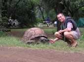
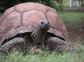
Next morning the rain was still
drizzling down and we packed up camp and then paid a visit to the camp
tortoise, who at 65 years of age is enjoying his retirement. It's kind
of cool having a camp giant tortoise rather then the usual camp dog
or cat.
 Today
shall lead us further north towards the great Lake Turkana, along who's
shores we shall continue northing into Ethiopia. We have chosen this
route for a few reasons, namely. It is more scenic then the main route
via Marsabit to Moyale, it shall take us back out into the middle of
nowhere where we can be self dependent again and it is without the problems
of tribal conflict that are affecting the Marsabit region at the moment.
Further it shall allow us a glimpse into the lives of the Turkana and
Samburu tribes that lives alongside the lake shore. Today
shall lead us further north towards the great Lake Turkana, along who's
shores we shall continue northing into Ethiopia. We have chosen this
route for a few reasons, namely. It is more scenic then the main route
via Marsabit to Moyale, it shall take us back out into the middle of
nowhere where we can be self dependent again and it is without the problems
of tribal conflict that are affecting the Marsabit region at the moment.
Further it shall allow us a glimpse into the lives of the Turkana and
Samburu tribes that lives alongside the lake shore.
First stop on our
itinerary is the small town of Maralal, home to the famous Camel Derby,
that was established and run by, would you believe, an Englishman from
Topsham......just over the river from where I grew up.........what a
small world.
 The
road north deteriorated quickly, no more tar till Ethiopia. Gravel turned
to sand and sand gave way to mud and bogholes. The nights rain had turned
the road into a big mud trap, further complicated by zig zagging detours
that led us into the thick undergrowth as we tried to avoid the major
bogholes. It was still drizzling and the drive was tiring but as is
always the case rewarding in the challenges it threw up. We hadn't seen
another vehicles all day, but as we slid our way down a particularly
bad section we saw another Landie coming toward us. As it neared we
saw its colouring was sandy brown military camouflage with a Union Flag
adorning it. It took me a few seconds to register and place the vehicle
in these unusual surroundings, but sure enough it was the British Army!!
We were both too busy navigating the mud to stop but waved as we passed.
What on earth we thought was a British Landie doing out here on its
own? We would discover the reason why the next morning. The
road north deteriorated quickly, no more tar till Ethiopia. Gravel turned
to sand and sand gave way to mud and bogholes. The nights rain had turned
the road into a big mud trap, further complicated by zig zagging detours
that led us into the thick undergrowth as we tried to avoid the major
bogholes. It was still drizzling and the drive was tiring but as is
always the case rewarding in the challenges it threw up. We hadn't seen
another vehicles all day, but as we slid our way down a particularly
bad section we saw another Landie coming toward us. As it neared we
saw its colouring was sandy brown military camouflage with a Union Flag
adorning it. It took me a few seconds to register and place the vehicle
in these unusual surroundings, but sure enough it was the British Army!!
We were both too busy navigating the mud to stop but waved as we passed.
What on earth we thought was a British Landie doing out here on its
own? We would discover the reason why the next morning.
We arrived at the GPS coordinates
for the Yare Camel camp. This is a true oasis in a flat barren land.
Originally set up and run by an Englishman, the camp is famous for the
camel derby, a kind of eccentric version of the famous horse Derby.
Sadly we are a month to early and so shall miss the spectacle of hundreds
of camels going flat out with their riders holding on for dear life..
The camp has good facilitates
and is very pleasant except that was for the weather that still drizzled
down making the way slippery as hell. Next day we woke to more rain
and made the decision to wait on the weather, unsure of how muddy the
pass over the escarpment would be or if indeed it was passable. Further,
our chance meeting with a group of US medical students and their teacher
had informed us that the head of the Anthropological dig at Kobi Fora
on the northern shore of Lake Turkana was currently on his way down
south and would be at the camp later in the afternoon, this meant we
would be able to gain valuable information on the route up along the
lake.
We headed into town
to buy supplies and check on the availability of diesel as it would
be prudent for us to refill our tanks before we head out into the unknown.
As we reached the outskirts of the small town we passed the police station,
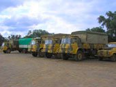
which to our surprise and amazement was full of sandy brown camouflage
Land Rovers and Bedford trucks. The British army was here in strength.
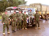
We pulled into the police station, pleased to see familiar faces. We
introduced ourselves to the guys and gals, of A(II) Med SQN 4 GS MR,
Aldershot. I wasn't sure who was the more surprised, us to see them
or them to see us. It turned out that the guys and gals were on a sort
of R&R that also served as a medical operation to assist local villages
with rare and exotic illnesses that local medical care could not treat.
The R&R element was in the time that could be taken to relax in
places like Mombassa, a treat well deserved as Major Nigel Partington
had informed us that the division had recently returned from a long
tour of duty in Iraq. As we readied to head into town the guys insisted
we return in the morning as they would have some treats for our onward
trip. Intrigued we headed to town to finish our chores.
Next day we rose early and headed
down the mud track to rendezvous with the guys before they broke camp
and shipped out back to Nairobi. When we arrived they were nearly decamped.
To Major Nigel, Capt Matt Oakes, Woz Dave Jenkin and all the guys and
gals of A (II) Med SQN a big big thank you for the gifts and words of
support with which you left us. Our trip was certainly more comfortable
and enjoyable after our restock of supplies and diesel. Your generosity
and friendship were wonderful and I felt proud. Thanks to all of you
and see you back home in blighty for a beer or two.
We headed back to camp and made
ready to leave, however as I made checks on the DuK, I discovered that
we had lost the mud guard on the front left disc brake, worse still
the brake pad had also been stripped from its metal bracket. The result
was horrible scaring on the disc and effectively no front left brake.
What made the matter worse was that I had no spare disc pads!!! So we
headed back into town and luckily found a shop selling automotive parts.
After changing the pads we were ready to go north into the unknown.
Tagebuch
Es hat die ganze Nacht geregnet
und die Hippos konnte ich auch hoeren, also bin ich nicht zum Pinkeln
aufgestanden und somit mit den ersten Sonnenstrahlen aufgestanden. Beim
Bootsteg habe ich die Kingfisher beim Fischen und die Hippos beobachtet.
Langsam ging die Sonne auf und dann wurde es schon wieder grau. Die
Hornbill-Voegel liebten unser Zelt und haben ueberall dran gepickt.
Wir haben zusammengepackt, es fing an zu regnen und die Strasse war
schlecht und unsere Reifen noch schlechter....Unterwegs nach Maralal
haben wir schon viele Samburu und ein paar Turkana Stammesleute gesehen.
Sehr interessant mit all ihren Ketten und Schmuck, sehr aehnlich wie
die Masai. Kurz vor Maralal haben wir dann einfach so in der Wildniss
ein paar Giraffen gesehen, mussten uns aber so konzentrieren dass wir
nicht von der Strasse abglitschen und im furchtbaren "Black Cotton
Soil" enden, dass wir das gar nicht so richtig wahrnehmen konnten.
Kamele gab es auch schon ein paar und um 14:15 Uhr sind wir im Yare
Safari Camel Club angekommen. Dieses Camp gehoerte mal einem Mann von
Topsham, Devon, und David war ganz aufgeregt, da das direkt gegenueber
ist von wo er herkommt.
 Wir
sind dann noch mal auf eine Rutschpartie ins Dorf gefahren um Internet
zu checken und zu sehen, wo Remo und Yvonne jetzt sind. Ein cooles Dorf,
was fast nur aus Samburus besteht, die einem dann auch noch in voller
Montur beim Emailen ueber die Schulter gucken..... Auf dem Rueckweg
haben wir kurz bei der Polizei angehalten um ueber die Sicherheitssituation
in der Region und am Lake Turkana zu fahren und haben gestutzt als wir
Land Rover und Bedford Trucks der British Army sahen. David hat sich
natuerlich gefreut und sofort mit den Jungs geredet und es stellte sich
heraus dass sie Medical Help hier machen, da sie das letzte Jahr in
Irak waren und in Kenya relaxen und gleichzeitig Impfungen durchfuehren.
Die waren total nett und lustig und ueberhaupt nicht die harten Jungs
vom Bund! Wir waren die einzigen die den Major mit seinem Vornamen ansprechen
durften und haben auch gleich Schokolade und noch mehr Mueckencreme
bekommen. Falls wir noch mehr braeuchten sollten wir morgen noch mal
wieder kommen bevor sie um 10:00 Uhr weiter fahren. Die Jungs konnten
uns und unsere Reise ueberhaupt nicht verstehen und haben immer gefragt
"Ihr habt aber Waffen dabei, oder?" mit Panik ueber Afrika
in den Augen.....Dabei kamen die gerade von der Front!!! Wir
sind dann noch mal auf eine Rutschpartie ins Dorf gefahren um Internet
zu checken und zu sehen, wo Remo und Yvonne jetzt sind. Ein cooles Dorf,
was fast nur aus Samburus besteht, die einem dann auch noch in voller
Montur beim Emailen ueber die Schulter gucken..... Auf dem Rueckweg
haben wir kurz bei der Polizei angehalten um ueber die Sicherheitssituation
in der Region und am Lake Turkana zu fahren und haben gestutzt als wir
Land Rover und Bedford Trucks der British Army sahen. David hat sich
natuerlich gefreut und sofort mit den Jungs geredet und es stellte sich
heraus dass sie Medical Help hier machen, da sie das letzte Jahr in
Irak waren und in Kenya relaxen und gleichzeitig Impfungen durchfuehren.
Die waren total nett und lustig und ueberhaupt nicht die harten Jungs
vom Bund! Wir waren die einzigen die den Major mit seinem Vornamen ansprechen
durften und haben auch gleich Schokolade und noch mehr Mueckencreme
bekommen. Falls wir noch mehr braeuchten sollten wir morgen noch mal
wieder kommen bevor sie um 10:00 Uhr weiter fahren. Die Jungs konnten
uns und unsere Reise ueberhaupt nicht verstehen und haben immer gefragt
"Ihr habt aber Waffen dabei, oder?" mit Panik ueber Afrika
in den Augen.....Dabei kamen die gerade von der Front!!!
Es hat natuerlich wieder nur absolut
geregnet und wir hatten darauf absolut kein Bock mehr. Unsere Reifen
machten uns zu schaffen und als es am naechsten Morgen wieder nur regnete
haben wir uns beschlossen, hier einen Tag zu warten und hoffen dass
die Strassen besser werden wenn es mal trocken wird und dass wir von
Remo und Yvonne hoeren.
Dann ging es wieder zur British
Army und wir haben ein bisschen gequatscht, die haben unsere Diesel
tanks aufgefuellt, ihre Rationen gegeben, Kekse und noch mehr Antimueckencreme!
Als sie fragten ob wir noch irgendwas braeuchten und ich im Scherz sagte,
ja, neue Reifen! Da haben sie nur gesagt, wieso habt ihr das gestern
nicht gesagt, wir haetten ein paar "Loecher arrangieren koennen"
und somit haetten wir 4 oder 6 neue gute Michelin XZL Profilreifen bekommen
koennen - David hat sich fast in Arsch gebissen! Na-ja, wir haben uns
bedankt und Photos gemacht und wurden auch gleich zur Weihnachtsfeier
in England eingeladen....Echt nette Leute!
Den Rest des Tages haben wir im
Regen ausgehagt und David ist zu Fuss ins Dorf gegangen um ein Teil
fuer DuK zu besorgen, das kaputt ging nachdem die Briten schon weg waren....
Where are
we: Lloyangalani,
Lake Turkana, Kenya
Date: 20th -21st
July 2005
End GPS: N02 45.583
E036 43.359
Total Kilometres: 64, 103km
Weather: Hot, very hot
Camping: El Molo Camp
 We
left camp and headed for the climb up the escarpment out of Maralal.
The weather thankfully was dry now and so the track was easy to climb.
Sadly the sunshine gave was to hazy conditions and so our views out
over Kenya were once again restricted. As we descended one track we
came upon a group of over one hundred local men and boys all dressed
in black robes and red jewellery. We assumed these were the guys that
had been circumcised , as we had been told that a big circumcision ceremony
underway in the region. It's always so interesting to see the tribes
of Africa going about their daily lives, how weird it must be for them
to have a couple of whities in a Land Rover passing them by. We
left camp and headed for the climb up the escarpment out of Maralal.
The weather thankfully was dry now and so the track was easy to climb.
Sadly the sunshine gave was to hazy conditions and so our views out
over Kenya were once again restricted. As we descended one track we
came upon a group of over one hundred local men and boys all dressed
in black robes and red jewellery. We assumed these were the guys that
had been circumcised , as we had been told that a big circumcision ceremony
underway in the region. It's always so interesting to see the tribes
of Africa going about their daily lives, how weird it must be for them
to have a couple of whities in a Land Rover passing them by.
The morning had us climbing and
descending along rocky and then sandy tracks, leading us through some
small villages of beehive thatch huts. Then the landscape changed as
the rocky highlands gave way to open sandy plains. Great fun for driving
in again. The villages petered out and we found ourselves once again
out in the wilderness on our own, how we like it. The land is like as
lunar landscape and as you near the shores of Lake Turkana its surface
becomes littered with millions of smooth, round, black boulders. It's
weird, as if someone has placed them there as some form of crazy modern
art. Years ago the only way to get to the lake was to drive over the
boulders, this would have taken hours as the boulders can not be driven
around or avoided and so the only way was to wobble your way over them.
It must have been extremely tiresome, but the reward of reaching the
lake made it worth while. Today the authorities have sanitised the final
40 km to the lake sure by concreting sections over the worse boulder
fields. It does detract from the adventure a little bit, but I was thankful
of the easier ride.
 These
boulder fields are the remains of lava flows that once covered the land
during the more volcanically active period of the lakes history. Lake
Turkana is the most northern of the Great Rift valley lakes, and it
is by far the most remote and the most beautiful. It takes your breath
away when you first see the silver mass of water in such a desolate
and barren landscape, towering mountains rising out of its depths on
its western shores like some scene from Lord of the Rings. The lake
is a soda lake that at the right time of day and year is famed for it
vivid Jade green colour. It is stocked full with fish that the localTurkana
and Samburu people harvest for their sustenance, their isn't much else
that grows or lives out here to ensure their survival. These
boulder fields are the remains of lava flows that once covered the land
during the more volcanically active period of the lakes history. Lake
Turkana is the most northern of the Great Rift valley lakes, and it
is by far the most remote and the most beautiful. It takes your breath
away when you first see the silver mass of water in such a desolate
and barren landscape, towering mountains rising out of its depths on
its western shores like some scene from Lord of the Rings. The lake
is a soda lake that at the right time of day and year is famed for it
vivid Jade green colour. It is stocked full with fish that the localTurkana
and Samburu people harvest for their sustenance, their isn't much else
that grows or lives out here to ensure their survival.
Years ago but still as recent
as the 70s the lake and surrounding area was abundant with a full array
of the African wildlife foodchain, from the smallest antelope to largest
lion. Sadly like so much of wildlife in Africa, years of pillage and
poaching by Somalian and Ethiopian insurgents has taken its toll and
the land is now devoid of the fauna that once thrived in this remote
area. Today the northern part of the lake is given over to a nature
reserve where thankfully the wildlife is being protected and staging
a comeback. It is probably one of the least visited national parks of
Kenya, but by far it is the most beautiful. OK you don't see huge swathes
of animals but you do have the chance of seeing Oryx, wild cats, the
rare Generuk ( a strange looking antelope with a smallish body and a
giraffe like neck) and a host of other Ungulates. The park is also famous
for the archeological finds made by the Leakey family in their years
of digging for mans ancient ancestors at Kobi Fora. Indeed for Anthropologists
this is the so called "Cradle of Mankind", yep, this is the
place where it all started, when "Lucy" got up off all fours
and walked upright for the first time. That is if you believe in Darwinism.........now
there's an old debating theme......
 The
lake is also home to some of Africas largest crocodiles, so swimming
in the lake must be undertaken with extreme caution. The lake itself
is vast and resembles are large inland sea, especially when the winds
wip the surface up into a white foaming broth and huge crashing waves.
Turkana was also afavourite spot for George Adamson, and it is here
that he at first considered releasing Elsa into the wild, the threat
posed by poachers however prevented this from being the case. But nevertheless
George and Joy visited the lake with Elsa on several safaris when George
was conducting game counts to monitor the extent of the impact that
poaching was having on the area. The
lake is also home to some of Africas largest crocodiles, so swimming
in the lake must be undertaken with extreme caution. The lake itself
is vast and resembles are large inland sea, especially when the winds
wip the surface up into a white foaming broth and huge crashing waves.
Turkana was also afavourite spot for George Adamson, and it is here
that he at first considered releasing Elsa into the wild, the threat
posed by poachers however prevented this from being the case. But nevertheless
George and Joy visited the lake with Elsa on several safaris when George
was conducting game counts to monitor the extent of the impact that
poaching was having on the area.
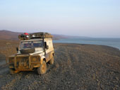
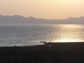
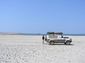
We arrived at the lakeshore just
in time to watch the wonderful site as the huge orange disc of the sun
sank lower and lower on the lake, casting long orange shimmering images
across its surface. As the sun touched the top of the western mountains
the whole landscape became bathed in an orang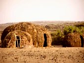 e
warm blanket. We stopped and toasted the end to a beautiful day with
our own golden whisky sundowner, before heading along the shingle track
to the small town of Lloyangalani, and a restful night camped amongst
the palm trees of El Molo camp. This is a tiny oasis the with natural
hot showers and a refreshing swimming pool. Just what is needed at the
end of a long dusty days drive. e
warm blanket. We stopped and toasted the end to a beautiful day with
our own golden whisky sundowner, before heading along the shingle track
to the small town of Lloyangalani, and a restful night camped amongst
the palm trees of El Molo camp. This is a tiny oasis the with natural
hot showers and a refreshing swimming pool. Just what is needed at the
end of a long dusty days drive.
Tagebuch
Wir sind endlich mal wieder zu
Sonnenschein aufgewacht und haben erfreut bezahlt und uns auf den Weg
nach Lake Turkana gemacht. Die Piste war schlecht aber ok und wir sind
an vielen interessanten Samburu, Turkana und Phokot oder so vorbeigekommen,
haben aber leider nicht den Mut gefasst um zu fragen ob wir photographieren
koennen. Schade, aber die Masai haben das bei mir abgeschreckt und ich
kann das Getue nicht ab.....
Es ging wieder ueber 2000 m hoch
und spaeter wurde die Landschaft immer karger und Wuestengleich. Wir
haben viele Kamele und DikDik (kleine Antilopen) gesehen. Dann Aloe
Pflanzen, Akazien, Straeusse, Kuherden und roten Afrikanischen Murumsand
und dabei kein Regen, herrlich!
 Immer
oefter sahen wir halbbekleidete Turkanafrauen mit nur Ketten als Schmuck,
sonst nichts am Oberkoerper und der Wind wurde heiss und trocken. Dann
ging es durch Vulkangestein huegelig bergab und bergauf und dann war
er ploetzlich da - Lake Turkana, und genauso Jadegruen wie auf jedem
Photo, wunderschoen! Es war kurz vor Sonnenuntergang und obwohl ein
bisschen diesig war es einfach nur ruhig und ein tolles Licht! Es waren
nur noch ein paar km, oder so dachten wir, bis nach Lloyangalani und
somit haben wir angehalten, Photos gemacht und mit Whisky auf diese
schoene Sicht angestossen und sind langsam weitergefahren. Es war genial!
Da waren ein paar Angler die in der Daemmerung gefischt haben und wir
haben uns einfach nur ueber die Gegend gefreut! Dann wurde uns klar
dass es doch noch 20 km waren und es wurde immer dunkler. Immer
oefter sahen wir halbbekleidete Turkanafrauen mit nur Ketten als Schmuck,
sonst nichts am Oberkoerper und der Wind wurde heiss und trocken. Dann
ging es durch Vulkangestein huegelig bergab und bergauf und dann war
er ploetzlich da - Lake Turkana, und genauso Jadegruen wie auf jedem
Photo, wunderschoen! Es war kurz vor Sonnenuntergang und obwohl ein
bisschen diesig war es einfach nur ruhig und ein tolles Licht! Es waren
nur noch ein paar km, oder so dachten wir, bis nach Lloyangalani und
somit haben wir angehalten, Photos gemacht und mit Whisky auf diese
schoene Sicht angestossen und sind langsam weitergefahren. Es war genial!
Da waren ein paar Angler die in der Daemmerung gefischt haben und wir
haben uns einfach nur ueber die Gegend gefreut! Dann wurde uns klar
dass es doch noch 20 km waren und es wurde immer dunkler.
 Wir
wollten gerade buschcampen, da kamen wir in Lloyangalani an, haben das
El Molo Camp in einer kleinen Palmenoase gefunden und camp aufgeschlagen.
Es war echt schoen hier! Ein sehr einfaches Camp mit outdoor Duschen
unter Palmen und ein Swimmingpool, cool! Wir haben sofort die anderen
Gaeste kennengelernt: da war Paul, ein britischer overland driver mit
dem David sich natuerlich sofort verstanden hat und wir ein bisschen
Party gemacht haben, und Klaus & Barbara, die mit ihrem Magirus
Deutz auch eine ganze Afrikareise unternehmen wollen und in Khartoum
einen kleinen Kater, Khartoum, mitgenommen haben. Nachdem uns draussen
zu viele Muecken waren und die Spanier ihre eigene Party machten, sind
wir fuenf dann in Klaus & Barbara's "Haus" verschwunden,
haben schoen Bier getrunken und uns nett unterhalten. Es ist ja immer
erfrischend, Mami und Papi, wenn man auch mal aeltere Leute sieht, die
so eine Reise geniessen und sich daran erfreuen! Wir hatten viel Spass
und wurden glatt ueberredet am naechsten Tag noch zu bleiben, was wir
auch gemacht haben. Man muss ja auch mal Waesche waschen...... Wir
wollten gerade buschcampen, da kamen wir in Lloyangalani an, haben das
El Molo Camp in einer kleinen Palmenoase gefunden und camp aufgeschlagen.
Es war echt schoen hier! Ein sehr einfaches Camp mit outdoor Duschen
unter Palmen und ein Swimmingpool, cool! Wir haben sofort die anderen
Gaeste kennengelernt: da war Paul, ein britischer overland driver mit
dem David sich natuerlich sofort verstanden hat und wir ein bisschen
Party gemacht haben, und Klaus & Barbara, die mit ihrem Magirus
Deutz auch eine ganze Afrikareise unternehmen wollen und in Khartoum
einen kleinen Kater, Khartoum, mitgenommen haben. Nachdem uns draussen
zu viele Muecken waren und die Spanier ihre eigene Party machten, sind
wir fuenf dann in Klaus & Barbara's "Haus" verschwunden,
haben schoen Bier getrunken und uns nett unterhalten. Es ist ja immer
erfrischend, Mami und Papi, wenn man auch mal aeltere Leute sieht, die
so eine Reise geniessen und sich daran erfreuen! Wir hatten viel Spass
und wurden glatt ueberredet am naechsten Tag noch zu bleiben, was wir
auch gemacht haben. Man muss ja auch mal Waesche waschen......
Where are
we: Near
border with Ethiopia
Date: 22nd
July 2005
End GPS: N04 09.848
E036 26.007
Total Kilometres: 64, 375km
Weather: Hot as hell
and very windy
Camping: Bushcamp YIPEEEEE!!!!!
 We
had expected to be alone out here so you can image our surprise when
we found ourselves drinking a beer with a truck load of Spanish, the
charming Barbara and Klaus in their Magirus Deutz truck, John and Ariana
in their Landie, and Paul, the driver of the overland truck. It was
really nice to meet new friends and share information on routes, especially
as they had all just come down from Ethiopia. And so we gained valuable
insight into the route ahead which would leave us very isolated, we
would certainly come to be thankful of one GPS coordinate that would
save our day..................more on that later. We
had expected to be alone out here so you can image our surprise when
we found ourselves drinking a beer with a truck load of Spanish, the
charming Barbara and Klaus in their Magirus Deutz truck, John and Ariana
in their Landie, and Paul, the driver of the overland truck. It was
really nice to meet new friends and share information on routes, especially
as they had all just come down from Ethiopia. And so we gained valuable
insight into the route ahead which would leave us very isolated, we
would certainly come to be thankful of one GPS coordinate that would
save our day..................more on that later.
After our relaxing stay in Lloyangalani
it was time for everyone to head off, the Spanish where flying out ans
so we all made our way down to the airstrip to watch the inbound flight.
We said our farewells to everyone and Kat and I headed off into the
northern territories. In our discussion with Paul et al. it had come
to our attention that it was possible to drive a track that would lead
us along the shore of the lake, rather then having to make the inland
detour via South and North Horr. We were assured this route was possible
by the guide who had come down with Paul on the truck. Armed with this
basic information we opted to take the shore route north. It all started
very well, we found the turning for the shore piste on the main piste
at the place described and set off towards the lake shore. The drive
was beautiful and rewarding as we drove between the mountains and the
lake shore. 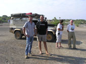
All signs of civilisation disappeared
as we found ourselves very much alone. The day was beautiful, clear
blue skies and hot with a strong breeze to cool us down. We drove for
nearly 3 hours when the first problem arose, taking the track by the
lake is all well and good except that it is necessary to cross dried
up river beds. On coming to one very large river bed or lugga as they
are locally referred to, we were faced with two potential risks and
one major issue. The first risk was that venturing into and along the
dried river course exposed us to very very soft sand, that should we
get stuck in could take us a lot of effort to extract ourselves from
(for some reason the sands in river courses are finer and therefore
much softer then desert sands), the second risk was that we still had
difficulty in engaging low range and keeping it in, if and when we managed
it. This presented us with a situation as this river course required
us to drive up the river and not just over it, this hence substantially
increased our exposure to getting bogged. When you are two cars this
is not such an risk as one can help to recover the other, provided they
haven't both ventured into the river course that is. With no option
other then turning around we ventured into the lugga, in high range
as low had refused to engage.
 The
sand was soft but our tires where at a suitable pressure that aloud
us to mainly skim over the top. All was going swimmingly until that
fateful moment when the tyre tracks we were following split. Not wanting
to stop in the soft sand we hastily chose the right set as they looked
fresher.........Ooops wrong ones, no sooner had they disappeared behind
some arcacia shrub then they came to literally a depressing end. No
choice but to swing the DuK around and pick up the other set. Again
no problem as we headed further up the river course, then to our horror
the track started to fade and then simply vanished. With no route notes
and no GPS coords to aim for we were very much on our own. We continued
on for another few hundred metres looking for an exit from the lugga
that would allow us back onto the track heading north. We simply could
not see one and now the sand was getting difficult, we opted for safety
and swung about heading back the way we had come into the lugga making
sure not to follow our first set of tracks that led to the dead end.
It is actually very easy to get lost in large luggas that have a lot
of scrub in them, especially if you start driving over you old tracks.
If you are not careful you can find yourself going around in circles.
This is where the Garmin V GPS is excellent, as it shows you your track
where you came from, hence all you do is follow the GPS and out you
pop where you went in. The
sand was soft but our tires where at a suitable pressure that aloud
us to mainly skim over the top. All was going swimmingly until that
fateful moment when the tyre tracks we were following split. Not wanting
to stop in the soft sand we hastily chose the right set as they looked
fresher.........Ooops wrong ones, no sooner had they disappeared behind
some arcacia shrub then they came to literally a depressing end. No
choice but to swing the DuK around and pick up the other set. Again
no problem as we headed further up the river course, then to our horror
the track started to fade and then simply vanished. With no route notes
and no GPS coords to aim for we were very much on our own. We continued
on for another few hundred metres looking for an exit from the lugga
that would allow us back onto the track heading north. We simply could
not see one and now the sand was getting difficult, we opted for safety
and swung about heading back the way we had come into the lugga making
sure not to follow our first set of tracks that led to the dead end.
It is actually very easy to get lost in large luggas that have a lot
of scrub in them, especially if you start driving over you old tracks.
If you are not careful you can find yourself going around in circles.
This is where the Garmin V GPS is excellent, as it shows you your track
where you came from, hence all you do is follow the GPS and out you
pop where you went in.
Now we had to make a call, to
back track the last three hours to the main piste or try and find another
track avoiding the lugga and heading north. We went for option 2 as
the last thing we needed was to burn valuable fuel backtracking so soon.
We set about looking for a track and luckily after a few minutes found
other tracks that did indeed lead around the lugga with just a simple
short crossing of it. The track had led us back east before it cut back
west to the lake sure. Imagine my frustration when I watch our track
from earlier on in the Lugga come back onto the GPS screen. When we
had turned back from the lugga little had we known that the track north
was just 20 metres in front of us. Our new route led us so close to
where we had been we could see our tracks where we had turned back.
Ah well. I just felt sorry for whoever came next and followed our tracks!!!
We continued our northing alone
the lake sure. Awesome is all I can say. White sands, silver green waters,
blue sky and a fresh breeze. Magical. The track was pretty good but
there were a few sections where it turned inland and where the tracks
became faint and even disappeared, b but not to such an extent that
they were impossible to find again. As we crossed one badly rutted section
we were suddenly confronted by two men, where they came from or where
going I have no idea. What did concern we was their fashion items of
rifle and AK47 and the fact that they were standing in the track and
beckoning for us to stop. That we did and with our pigeon Swahili exchange
greetings. These two fearsome warriors actually turned out to be a sweet
couple of elders who were just curious why two whities in Landie where
driving through their neck of the woods.
 We
had now been on the track for well over 6 hours and we hadn't seen any
sign of villages or people, except the two old dudes. The tracks were
strong and fresh and following them was no problem, we also constantly
had the Lake to our left as a major indication that we where indeed
heading North toward Ethiopia. As we rounded a bend we saw in the distance
a radio mast. We naturally assumed this was the national park gate where
we were to pick up another trial that would take us west and then north
along the shoreline. Ha ha No!! Our excitement at reaching this way
marker was short lived as we drove nearer the mast. It seemed we had
grossly overestimated our progress. The mast turned out to belong to
an abandoned outpost and village. The place was a ghost town, eerie
as the beehive huts all sat quiet and empty, where are are all the people
we questioned, and then we started to get a little concerned. The Northern
regions of Kenya are renowned for their tribal conflict and massacres
at the hands of Somalian shifta, we had come this route so as to avoid
Moyale where 200 hundred villagers and a white Italien Bishop had just
recently been massacred in a feud over cattle grazing and access to
waterholes. Had we stumbled into another village where tribal conflict
had caused the people to flee, where there Shifta about, where we in
danger. These questions didn't stay long as a new problem raised its
unwelcome head. To our disbelief the tracks we had been following all
day went to the Radio mast building where they promptly turned around
and went back the way they had come. We hadn't been following a well
used trail all day at all, what we had been seeing was the outbound
set of tyre tracks and the the fresher returning tyre tracks. Not a
problem we told ourselves we will find more tracks that lead north.
On the GPS Kobi Fora was shown on a bearing as being 120km north. Easy
all we would do was follow the shore line. We jumped in the DuK and
headed out of the deserted village, we got precisely 40 metres before
our progress was halted by a 2o metre drop into a large river course,
we decided to head west to find a way down and across but with no luck,
so we headed east but again with no luck. We drove back to where we
first met the drop into the lugga and did what is normal in such situation,
took in a deep breath and said "SHITTTT!" We
had now been on the track for well over 6 hours and we hadn't seen any
sign of villages or people, except the two old dudes. The tracks were
strong and fresh and following them was no problem, we also constantly
had the Lake to our left as a major indication that we where indeed
heading North toward Ethiopia. As we rounded a bend we saw in the distance
a radio mast. We naturally assumed this was the national park gate where
we were to pick up another trial that would take us west and then north
along the shoreline. Ha ha No!! Our excitement at reaching this way
marker was short lived as we drove nearer the mast. It seemed we had
grossly overestimated our progress. The mast turned out to belong to
an abandoned outpost and village. The place was a ghost town, eerie
as the beehive huts all sat quiet and empty, where are are all the people
we questioned, and then we started to get a little concerned. The Northern
regions of Kenya are renowned for their tribal conflict and massacres
at the hands of Somalian shifta, we had come this route so as to avoid
Moyale where 200 hundred villagers and a white Italien Bishop had just
recently been massacred in a feud over cattle grazing and access to
waterholes. Had we stumbled into another village where tribal conflict
had caused the people to flee, where there Shifta about, where we in
danger. These questions didn't stay long as a new problem raised its
unwelcome head. To our disbelief the tracks we had been following all
day went to the Radio mast building where they promptly turned around
and went back the way they had come. We hadn't been following a well
used trail all day at all, what we had been seeing was the outbound
set of tyre tracks and the the fresher returning tyre tracks. Not a
problem we told ourselves we will find more tracks that lead north.
On the GPS Kobi Fora was shown on a bearing as being 120km north. Easy
all we would do was follow the shore line. We jumped in the DuK and
headed out of the deserted village, we got precisely 40 metres before
our progress was halted by a 2o metre drop into a large river course,
we decided to head west to find a way down and across but with no luck,
so we headed east but again with no luck. We drove back to where we
first met the drop into the lugga and did what is normal in such situation,
took in a deep breath and said "SHITTTT!"
 We
got the binos out and surveyed the land around us, rocky hills to the
east, a big hole in front of us and a boulder strewn shoreline of the
lake to the west. What was worse was there was absolutely no sign of
any tracks and when we looked further north all we could see was a peninsula
with a lot of very large rocks cascading into the deep waters of the
lake. We were no absolutely "up the creek without a paddle".
We weighed up our options, the route north was blocked by a 20 metre
drop into a lugga, the way east by boulders and the way east by mountains.
After some moments we realised our only options were to either drive
6 hours back to the main piste via south and north Horr or to try and
find another track. The second option didn't seem very favourable as
we hadn't seen anything resembling a track all day, bar the one we had
followed. We flicked through the basic notes that Paul et al. had given
us and just as we were about to give up, my beautiful wife discovered
a GPS coordinate for where the south/ north Horr tracks met the track
coming from the west of the park. It wasn't much but it gave us a point
to aim for where we knew the tracks to be. On the GPS the point was
shown on a bearing of NNE and at a distance of 50km in straight line.
The only thing that stood between us and that point was a rather large
rocky mountain. We
got the binos out and surveyed the land around us, rocky hills to the
east, a big hole in front of us and a boulder strewn shoreline of the
lake to the west. What was worse was there was absolutely no sign of
any tracks and when we looked further north all we could see was a peninsula
with a lot of very large rocks cascading into the deep waters of the
lake. We were no absolutely "up the creek without a paddle".
We weighed up our options, the route north was blocked by a 20 metre
drop into a lugga, the way east by boulders and the way east by mountains.
After some moments we realised our only options were to either drive
6 hours back to the main piste via south and north Horr or to try and
find another track. The second option didn't seem very favourable as
we hadn't seen anything resembling a track all day, bar the one we had
followed. We flicked through the basic notes that Paul et al. had given
us and just as we were about to give up, my beautiful wife discovered
a GPS coordinate for where the south/ north Horr tracks met the track
coming from the west of the park. It wasn't much but it gave us a point
to aim for where we knew the tracks to be. On the GPS the point was
shown on a bearing of NNE and at a distance of 50km in straight line.
The only thing that stood between us and that point was a rather large
rocky mountain.
With the GPS coord we decided
to retrace our tracks for 10km to see if we could find a track leading
east inland and around the mountain. As we drove Kat notice what looked
like a very faint track. We reversed and turned in the direction east
and went bundi bashing i.e. making our own trail. With a GPS cood to
aim for we decided Bundi bashing was better then retracing 6 hours driving.
Our decision paid off, after 30km the scrub and luggas became easier
and then to our delight a visible set of track appeared that got more
and more defined. What was even better was they were heading for the
GPS coord. Our day was saved and after another 2 hours we popped out
on the main piste that went to North Horr and the National Park. After
another 30km we were at the park gate.
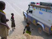 Our
meeting with the head of the anthropological dig at Kobi Fora had advised
us that the park wardens would ask us to pay to go through the park,
but that if we explained we were merely transiting enroute to Ethiopia
and to mention his name there should not be a problem. Haha No! The
guys were insistent that we pay $30US each to drive into the park. After
5 minutes we realised we were getting nowhere and so we reverted to
plan by that had also be suggest by the head. If they won't let you
transit without paying, just get back in the car, reverse and drive
around the barrier, so long as you do truely transit the park and not
stop in it overnight they cannot do anything. And so that is exactly
what we did. I think the wardens must be use to it as when we drove
through they simple waved and went back to their house. The drive through
the park was nice and the tracks were mainly in a good state of repair
and a mix of rocky and sandy. We did have to make a detour to the west
as the track straight north led into a lugga and very very soft deep
sand. We exited the park at around 19:00 and according to the GPS we
were just 70km from the Ethiopian border. We pulled off the track and
made a very nice quiet and relaxed bushcamp, indulging in a full shower
to wash away the dust and aches and pains of nearly 10 hours of driving.
All in all it had been a hell of a day........ Our
meeting with the head of the anthropological dig at Kobi Fora had advised
us that the park wardens would ask us to pay to go through the park,
but that if we explained we were merely transiting enroute to Ethiopia
and to mention his name there should not be a problem. Haha No! The
guys were insistent that we pay $30US each to drive into the park. After
5 minutes we realised we were getting nowhere and so we reverted to
plan by that had also be suggest by the head. If they won't let you
transit without paying, just get back in the car, reverse and drive
around the barrier, so long as you do truely transit the park and not
stop in it overnight they cannot do anything. And so that is exactly
what we did. I think the wardens must be use to it as when we drove
through they simple waved and went back to their house. The drive through
the park was nice and the tracks were mainly in a good state of repair
and a mix of rocky and sandy. We did have to make a detour to the west
as the track straight north led into a lugga and very very soft deep
sand. We exited the park at around 19:00 and according to the GPS we
were just 70km from the Ethiopian border. We pulled off the track and
made a very nice quiet and relaxed bushcamp, indulging in a full shower
to wash away the dust and aches and pains of nearly 10 hours of driving.
All in all it had been a hell of a day........
Tagebuch
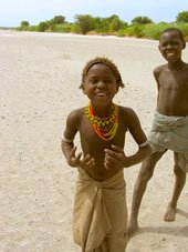 Wir
hatten eine sehr schoene Fahrt heute, obwohl wir uns verfahren haben
und nicht genau wussten wo es lang geht. Es war tierisch heiss und trocken
aber wunderschoen. Zuerst ging es immer am Lake Turkana entlang und
da die anderen uns erzaehlt haben man kann so weiter fahren und muss
nicht den Umweg ueber North Horr fahren, wollten wir dies versuchen,
hatten aber weder Karten noch GPS Punkte..... Am Anfang haben wir uns
noch an der Landschaft und den paar Stammesleuten erfreut aber dann
wurden wir etwas beaengstigt. Ploetzlich kamen wir zu einem verlassenen
Kraal, wo alle Huetten leer standen, Tueren offen waren und keine Menschenseele.
Von hier konnten wir nicht weiter in den Norden fahren, da die Huegel
bis in den See runterreichten. Vor uns war ein riesiges trockenes sandiges
Flussbett und wir konnten keine Spuren mehr sehen. Das Fernglas kam
raus und trotzdem keine Spuren. Wir sind noch weiter rumgefahren konnten
aber weit und breit keinen Weg finden. Also ging's zurueck und ploetzlich
habe ich, als alter Buschtracker :) haha, dann alte kaum erkennbare
Reifenspuren gesehen. Diesen sind wir dann kreuz und quer durch den
Busch gefolgt bis wir nach ca. einer Stunde auf eine Hauptpiste getroffen
sind, zum Glueck - also nicht 90 km ganz zurueck! Von hier ging die
Piste nach Kobi Fora und durch den Sibiloi Park, der nicht mehr viele
Tiere, dafuer aber Archaelogische Ausgrabungstaetten beherbergt. Wir
hatten eine sehr schoene Fahrt heute, obwohl wir uns verfahren haben
und nicht genau wussten wo es lang geht. Es war tierisch heiss und trocken
aber wunderschoen. Zuerst ging es immer am Lake Turkana entlang und
da die anderen uns erzaehlt haben man kann so weiter fahren und muss
nicht den Umweg ueber North Horr fahren, wollten wir dies versuchen,
hatten aber weder Karten noch GPS Punkte..... Am Anfang haben wir uns
noch an der Landschaft und den paar Stammesleuten erfreut aber dann
wurden wir etwas beaengstigt. Ploetzlich kamen wir zu einem verlassenen
Kraal, wo alle Huetten leer standen, Tueren offen waren und keine Menschenseele.
Von hier konnten wir nicht weiter in den Norden fahren, da die Huegel
bis in den See runterreichten. Vor uns war ein riesiges trockenes sandiges
Flussbett und wir konnten keine Spuren mehr sehen. Das Fernglas kam
raus und trotzdem keine Spuren. Wir sind noch weiter rumgefahren konnten
aber weit und breit keinen Weg finden. Also ging's zurueck und ploetzlich
habe ich, als alter Buschtracker :) haha, dann alte kaum erkennbare
Reifenspuren gesehen. Diesen sind wir dann kreuz und quer durch den
Busch gefolgt bis wir nach ca. einer Stunde auf eine Hauptpiste getroffen
sind, zum Glueck - also nicht 90 km ganz zurueck! Von hier ging die
Piste nach Kobi Fora und durch den Sibiloi Park, der nicht mehr viele
Tiere, dafuer aber Archaelogische Ausgrabungstaetten beherbergt.
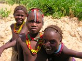 Eigentlich
muss man 30 US$ Eintritt bezahlen, aber wir haben versucht dem Typen
klar zu machen, dass wir nur auf die andere Seite und nach Aethiopien
wollen. Er wollte uns partout nicht durchlassen und als er kurz verschwand
sind wir frecherweise dem Beispiel anderer gefolgt und einfach ueber
die Markierungssteine rueber in den Park reingefahren. Wir hatten eine
kleine Verfolgungsjagd und tatsaechlich doch noch eine schoene Herde
Gemsboecke, eine Afrikanische Wildkatze und erstaunlicherweise endlich
mal Generuk (eine Antilope mit langem Hals) gesehen, das war toll! Nach
einer Stunde waren wir raus aus dem Park, wo es kein Tor gibt und haben
sofort ein Buschcamp gefunden und schoen gecampt. Erst gab es eine Buschdusche
(herrlich so nackt im Busch den Staub abzuduschen, wenn keiner da ist
und die Sonne gerade untergeht!), dann haben wir camp gemacht, gegessen
und sind zufrieden ins Bett gegangen. Eigentlich
muss man 30 US$ Eintritt bezahlen, aber wir haben versucht dem Typen
klar zu machen, dass wir nur auf die andere Seite und nach Aethiopien
wollen. Er wollte uns partout nicht durchlassen und als er kurz verschwand
sind wir frecherweise dem Beispiel anderer gefolgt und einfach ueber
die Markierungssteine rueber in den Park reingefahren. Wir hatten eine
kleine Verfolgungsjagd und tatsaechlich doch noch eine schoene Herde
Gemsboecke, eine Afrikanische Wildkatze und erstaunlicherweise endlich
mal Generuk (eine Antilope mit langem Hals) gesehen, das war toll! Nach
einer Stunde waren wir raus aus dem Park, wo es kein Tor gibt und haben
sofort ein Buschcamp gefunden und schoen gecampt. Erst gab es eine Buschdusche
(herrlich so nackt im Busch den Staub abzuduschen, wenn keiner da ist
und die Sonne gerade untergeht!), dann haben wir camp gemacht, gegessen
und sind zufrieden ins Bett gegangen.
Where are
we: Arba
Minch, Ethiopia
Date: 23rd July 2005
End GPS: N06 00.299
E037 33.086
Total Kilometres: 64, 798km
Weather: Sunny and Hot
Camping: Bekele Mola
Hotel
We woke early to get a good start
on the day, as we unsure of how the border crossing to Ethiopia shall
be. The problem with this crossing is that there is no official Kenyan
post and so we shall not get an exit stamp in our passports or on our
carnet. Further the problem is that the border post for Ethiopia is
to the west about 40km and so we have chosen not to get stamped in until
we get to Addis Ababa, more on this later.
The run from the park to the border
is via a series of sandy tracks but the going is easy and we soon made
the border according to the GPS, nothing to be seen but a dry river
bed. So here we are finally in Ethiopia, we only have 2 more countries
on our African leg of the journey. We finally picked up a maram road
that shall lead us east towards the Stefanie National Park and then
up into the high lands of Aba Minch. The drive is reminiscent of that
in Lesotho, running up and down into valleys and over passes and distances
that point to point are a mere 10 or 20 km become 50 or 60 as you skirt
around the mountains. It's strange to be driving on roads again where
there are so many people. In fact this is the major hazard in Ethiopia,
as the people and animals use the roads as their personal highways.
I have never seen so many people and cattle on roads. We finally reached
the town of Aba Minch after dark, due to the considerably convoluted
road network. We were glad to get to the hotel were we could camp, having
nearly been run off the road and down an embankment by a lorry and suffering
a blow out on the front tyre. Luckily we could eat a good meal and celebrate
being in a new country with a good cold beer. It was nice to get to
a fairly decent hotel where we could unwind and relax again.. Oh one
thing to remember when coming into Ethiopia after nearly a year of driving
on the left is that here they drive on the right.......thought I might
just remind you as we totally forgot......
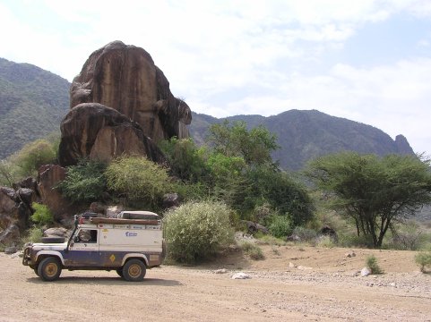
Tagebuch
Wir hatten nachts Vollmond, wunderschoen,
leider auch zu viel hektischen Wind, also nicht gut geschlafen! Es ging
frueh weiter Richtung Aethiopien. Erst mussten wir noch unseren Reifen
aufpumpen, da wir einen schleichenden Platten hatten, dann gings los.
Es wurde schon sehr heiss und windig und nach kurzer Zeit sind wir in
Illeret eingerollt. Hier haben wir nach Remo und Yvonne gefragt und
wurden ein bisschen von der Polizei befragt. Dann sind wir durch ein
weites Flussbett gefahren an ein paar Turkana Leuten vorbei und nun
waren wir in Aethiopien, cool! Eigentlich wollten wir von hier nach
Omerate um wenigstens nach Aethiopien eingestempelt zu werden wenn schon
nicht aus Kenia rausgestempelt, aber da waren tausende Pisten und wir
haben die nach Osten genommen und sind nie an einen Grenzposten vorbei
gekommen.
So, jetzt sind wir in Aethiopien
angekommen und an vielen interessanten Stammesleuten vorbeigekommen.
Die Piste bekam eine gute Hauptpiste und die Landschaft war sehr beeindruckend
und wir haben fast keine Menschen mehr gesehen als wir in den Stefanie
Park gefahren sind. Hier haette man gut bushcampen koennen aber wir
wollten weiter und dann schon wieder bis in die Daemmerung gefahren,
als wir in Arba Minch ankamen, nachdem wir fast von einem verrueckten
Truckfahrer von der Strasse geschleudert wurden! Alle Schilder sind
in Amharic, die lokale Sprache, und wir haben nach dem Bekele Mola Hotel
an einer Tankstelle gefragt. Der Typ hat nur gesagt das Hotel waere
voll! Toll, wieder eine supertolle Antwort von einem Afrikaner! Ich
hab nur gesagt das wollten wir nicht wissen, sondern wo es ist und dann
sind wir abgebraust. Nach einer Weile haben wir einen netten Menschen
getroffen der uns eine Wegbeschreibung gegeben hat. Als wir ankamen
konnten wir dort campen und haben uns ein dinner gegoennt. Leckeren
Fisch aus dem Chamo See, Gemuese und Aehtiopisches Bier, man hat es
gut!
Where are
we: Awasa,
Ethiopia
Date: 24th July 2005
End GPS: N07 04.553
E038 29.035
Total Kilometres: 65, 084km
Weather: Hot and big
thuderstorm later
Camping: Took room at
Adenium Camp as they are so nice (but you can also camp)
We are heading east at the moment
to pick up the main tar road that shall lead us north to Addis, first
we will stop in the town of Awasa as it is half way and there is recommended
the Adenium camp run by a German woman and her Ethiopian husband. The
run over was unexciting, the weather is poor and we had to navigate
through thick fog as we climbed the mountain passes. The road is tar
but progress is still being hampered by the thousands of people and
animals on the road. Further we have experienced the Ethiopian child,
an annoying creature that either shouts give me sweet or give me money
or failing these throws stones at the Landie, I'm going to start cutting
notches on the bull bar with them if they aren't careful......... Adenium
camp is very nice and a great place to stop if on the way too or coming
from Kenya. Its small but cosy and very clean with excellent cooking.
Here we also met Steve a Swiss guy traveling with his Swiss Mountain
dog Benson. More on these two when we met again in Sudan. The town of
Awasa is unexciting however it is located on a lake which to those who
like to stand with their rod in their hand, it does apparently have
good fishing.
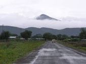
Tagebuch
Na-ja, schon wieder Regen! Also
Fruehstueck im Restaurant, dann zur Tankstelle und dann die Strasse
hoch durch die Berge und in die Wolken. Aethiopien ist unglaublich,
ueberall sind Menschen und Tiere, die rennen den ganzen Tag und Nacht
auf der Strasse rum, ueber die Strasse und wundern sich warum da Autos
rumfahren! Unsere Hupe hat schon wieder fast den Geist aufgegeben und
funktioniert nur wenn man sie gerade nicht braucht, also nicht sehr
hilfreich!
Am Nachmittag sind wir in Awassa
angekommen und haben bei Jana und Kurati, ein Deutsch-Aethiopien Paar,
haltgemacht und gleich ein kleines Zimmer genommen. Es fing schon wieder
an zu regnen und wir waren froh im Zimmer zu sein und Jana macht unglaublich
gutes hausgemachtes Essen - ahh eine Wohltat! Spaeter ist ein Range
Rover angekommen und Steve, ein Schweizer, und Benson, ein Mischling
aus Berner Sennhund, Rottweiler und Schaeferhund waren da. Matt, ein
Kanadier Backpacker war auch da, und wir haben alle zusammen Bier getrunken
und leckeres hausgemachtes Essen gegessen, bevor wir in unser Zimmer
gegangen sind und gleich zwei Filme auf dem Laptop geguckt haben - schoen!
Where are
we: Addis
Abeba, Ethiopia
Date: 25th -29th
July 2005
End GPS: N09 01.850
E038 46.492
Total Kilometres: 65, 457 km
Weather: Mixed bad of
rain, sun and cloudy
Camping: Bel Air Hotel
We made the short run to Addis.
Addis is so unlike my pre conceived ideas of what it would look like,
as is the case with so many African cities. I had expected a rambling
shanty town of prefabs, plastic covered huts, a maze of dirt alleys
and sand streets with a kind of wild west feel. What you get instead
is a thriving urban metropolis. The UN and expat community is thriving
here, bathing in the money and aid that came pouring into the country
back in the 80s and 90s. Like every country where aid has washed over
the country like a tidal wave, the people and the land now stand divided.
Aid may solve in some way an immediate human crisis, but in the long
run it brings the corruption, greed, incompetence and destruction of
a peoples innocence.
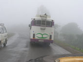 Ethiopia
stands as a nation divided, the haves and the have-nots has never been
greater. Many people got rich on the back of those images of the starving
and dead, and they still are today. Ethiopians however, are not poor,
their culture is unique in Africa, they are a proud people and they
are hard workers, proud of who they are and their ancestry. Do not expect
to come to a land of dust and desert, of barrenness. Ethiopia is a fertile
land and is intensively farmed today, it is lush and green in the highlands.
Then there are the low lands to the east that border to Somalia, Djibouti
and Eritrea. Here life is hard, but we did not go so I cannot comment.
But for all its riches, Ethiopia is a country weakened. It's people
are recovering well from years of war, famine and aid, but it is the
latter that is taking the longest time to recover from. People become
scarred by aid, there expectations change. Too often the legacy of aid
is found not in the elders but in the children born after the years
of famine. For they grew up in a country where they saw aid agencies
freely distributing goods and supplies. Now the aid is slowing down
these children of aid, look and wonder why? Because they expect to be
supported as young adults they all to often expect others to give to
them for nothing in return, and it is these people, the victims of aid
without education, that often cause a misunderstanding and misconception
of Ethiopia. All to often I here negative things of Ethiopia, some are
true, but are the route cause of the past and the failure to educate
a people on how aid works. The majority of critics comments on Ethiopia
are however just slanderous or born out of naivety, ignorance or intolerance.
Ethiopia also has a difficult place geographically, as far as travellers
are concerned. It is the divide between the Arab north and the Black
south, as such it is a melting pot. Ethiopia
stands as a nation divided, the haves and the have-nots has never been
greater. Many people got rich on the back of those images of the starving
and dead, and they still are today. Ethiopians however, are not poor,
their culture is unique in Africa, they are a proud people and they
are hard workers, proud of who they are and their ancestry. Do not expect
to come to a land of dust and desert, of barrenness. Ethiopia is a fertile
land and is intensively farmed today, it is lush and green in the highlands.
Then there are the low lands to the east that border to Somalia, Djibouti
and Eritrea. Here life is hard, but we did not go so I cannot comment.
But for all its riches, Ethiopia is a country weakened. It's people
are recovering well from years of war, famine and aid, but it is the
latter that is taking the longest time to recover from. People become
scarred by aid, there expectations change. Too often the legacy of aid
is found not in the elders but in the children born after the years
of famine. For they grew up in a country where they saw aid agencies
freely distributing goods and supplies. Now the aid is slowing down
these children of aid, look and wonder why? Because they expect to be
supported as young adults they all to often expect others to give to
them for nothing in return, and it is these people, the victims of aid
without education, that often cause a misunderstanding and misconception
of Ethiopia. All to often I here negative things of Ethiopia, some are
true, but are the route cause of the past and the failure to educate
a people on how aid works. The majority of critics comments on Ethiopia
are however just slanderous or born out of naivety, ignorance or intolerance.
Ethiopia also has a difficult place geographically, as far as travellers
are concerned. It is the divide between the Arab north and the Black
south, as such it is a melting pot.
We will stay in Addis for a while
to sort out the Egyptian visa and get our immigration stamps. We have
met up with Remo and Yvonne who are recovering from being mugged by
a Matatu bus. Poor Remo got dragged along as the robbers tried to get
away. Luckily there were police on the scene and the damage was limited,
although I think the emotional and psychological scares will take a
long time to heal. Further we shall stay a few days as they have also
just tested positive for Falasiparium Malaria and will need to go on
a course of Artesunate. We didn't get the Egyptian visa here in the
end as it was very expensive, we shall try again in Sudan. We also failed
to get stamped into Ethiopia, even though we went to the main immigration
and saw the head man. They have promised to radio the border to let
them know to stamp us out regardless of the fact we never got stamped
in. OK? Nobody seemed that bothered that we were totally illegal in
the country and that the car was illegally importaed............Ah Africa.
From Addis Kat and I have decided to head north west to the town of
Bahir Dar on Lake Tana. It is suppose to be very nice there and so we
shall check it out. Ethiopia is very different to all the other African
countries we have been too. The people have an entirely different look
and culture and it is a lot more in your face, but it is cool and very
friendly. We kind of like it here, even though the weather is against
us and we have constant rain and cold cold nights.
We have also grown 8 years younger
since coming into Ethiopia and the day never gets later then 12:00.
Ethiopia has it own Amharic calendar and time system, so while it is
2005 back home it is only 1997 here.
Tagebuch
Wie schoen es ist mal wieder ein
Zimmer zu haben! Wir haben den Morgen damit verbracht zu lesen und sind
dann spaet losgekommen. Die Leute rennen schon wieder alle auf der Strasse
rum und denken noch sie sind mitten im Busch, unglaublich! Eine Kolonne
von Eselkarren kommt uns entgegen und Kuehe sind ueberall. Da kann man
sich auch nicht wundern dass man so viele tote Tiere ueberall sieht.
Aethiopien war das schlimmste Land in Afrika fuer uns, wo man tote Tiere,
Hunde ueberall, Esel, Kuehe, Ziegen usw. sieht, echt schrecklich! Heute
hab ich gezaehlt und 6 tote aufgeblasene blutige Hunde gesehen, 3 Esel,
2 Kuehe und 4 Ziegen in einem Abstand von hoechstens 200 km ! Und die
Menschen gehen auch leichtsinnig auf die Strasse...
U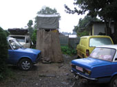 m
16:45 Uhr sind wir kurz vor Addis Ababa angekommen und haben schon wieder
3 tote Hunde gesehen. Dann in Addis haben wir versucht das Bel Air Hotel
zu finden, wo man campen kann. Unterwegs waren tierisch viele Toyota
Autos als Taxis und ganz viele suesse Kaefer und UN-Autos! Wir haben
das Bel Air Hotel gefunden, sah schon wieder nach einem Stundenhotel
aus.....Remo und Yvonne waren da. Wir haben uns gefreut aber die beiden
haben ein Zimmer genommen und fuehlten sich nicht so gut. David hat
unsere Elektrizitaet am Landy repariert und wir haben gekocht und uns
ein bisschen um R&Y gekuemmert und uns schoen unterhalten. m
16:45 Uhr sind wir kurz vor Addis Ababa angekommen und haben schon wieder
3 tote Hunde gesehen. Dann in Addis haben wir versucht das Bel Air Hotel
zu finden, wo man campen kann. Unterwegs waren tierisch viele Toyota
Autos als Taxis und ganz viele suesse Kaefer und UN-Autos! Wir haben
das Bel Air Hotel gefunden, sah schon wieder nach einem Stundenhotel
aus.....Remo und Yvonne waren da. Wir haben uns gefreut aber die beiden
haben ein Zimmer genommen und fuehlten sich nicht so gut. David hat
unsere Elektrizitaet am Landy repariert und wir haben gekocht und uns
ein bisschen um R&Y gekuemmert und uns schoen unterhalten.
Die naechsten Tage haben wir damit
verbracht Addis kennenzulernen, waren auf dem Markt, der es nicht Wert
ist dahin zu gehen, im Internet und an Provisionen aufstocken. Remo
und Yvonne hatten beide Malaria, wir haben unsere Testingkits benutzt
es herauszufinden und zum Glueck hatten sie noch Artesunate um diese
zu bekaempfen. Wir haben abends gekocht um den beiden etwas Staerke
zu geben und uns mit dem Hotelhund, Jumbo, angefreundet. Als es R&Y
besser ging und wir nichts mehr in Addis zu tun hatten sind wir endlich
weiter gefahren und wollten uns spaetestens 5 Tage spaeter in Lalibela
treffen.
Where are
we: Marco
Debre, Ethiopia
Date: 30th July 2005
End GPS: N10 19.929
E037 43.729
Total Kilometres: 65, 757 km
Weather: Mixed bag
Camping: Shebell Hotel
(took room as no where to camp and had a really crap day)
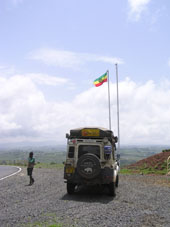 Today
would be our worst drive so far in Africa, one is always aware of the
potential for accidents to occur and today they did. The day had started
well, we rose early ate a healthy breakfast and set off climbing the
hills leading us out of Addis enroute to Bahar Dar. Today
would be our worst drive so far in Africa, one is always aware of the
potential for accidents to occur and today they did. The day had started
well, we rose early ate a healthy breakfast and set off climbing the
hills leading us out of Addis enroute to Bahar Dar.
Remo and Yvonne were still recovering
from malaria so Kat and I had decided to venture northwest to see this
area before heading back east to Lalibela and the eastern loop of Ethiopia.
The road is good tar and we made
fine progress. This route leads you to the Blue Nile Gorge, a spectacular
tear in the earth crust at the bottom of which flows the Nile on its
way north to the Mediterranean. At the top you are at an altitude of
2400 metres and as you descend the switch back gravel road your altitude
drops off at an alarming rate, by the time you reach the bottom you
are at a mere 300 metres, before you know it you are climbing again
sharply and by the top you are back at 2500 metres. The journey down
and up has taken over an hour yet the distance from one side of the
gorge to the other is perhaps a mere kilometre.
After the gorge the road went
back to tar but then it deteriorated where they have simply tarred over
black cotton soils. As such the road becomes a roller coaster made worse
by the people and animals and eh small town that you have to drive through.
It was in one of these small towns where the day went horribly wrong.
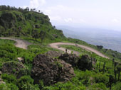 As
we drove through town are speed was very slow, perhaps 10 or 15 kilometres
an hour. The road was littered with people and animals and other traffic
coming the opposite direction. We were being approached by a large lorry
and people where crossing between us and it. At this point the lorry
blew its horn to warn the people that it was coming. Ethiopians have
no appreciation that roads are generally built for cars and not pedestrians,
so they simply do not look or move. The people crossing sped up to get
over before the truck. We were now along side most of them, when suddenly
an old man decided he wasn't going to cross and instead turned around
and walked straight in front of the Landie. I had no time to react,
he literally walked straight in front. As we made contact there was
a sickening thud. I hit the brakes and we stop instantly. The man had
disappeared under the front of the DuK and as I went to jump out, I
half expected to see him wedged under the front left wheel. But someone
was looking after him and us, for as I went to get out he suddenly sprung
up in front of us. Looked around completely puzzled as to what had happened
and then started to hobble to the side of the road. It was at this point
that the whole village became animated. People appeared from everywhere
and by the time I reached the old man a crowd of over a 100 people had
gathered. The scene was not very comfortable and I feared a little for
our safety should the old man be badly hurt. Thankfully at this time
the lorry driver appeared, who spoke good English. We sat with the old
man and asked how he was. It appeared he was OK except for his should
which he was holding and wincing in pain. The lorry driver explained
it was best we go because of the crowd, but that we should stop at the
police just up the road to let them know what had happened. This we
duley did, but two things amazed us. The first was that the crowd not
at all interested in the well being of the old man had instead chosen
to chase after us in attempt to extort money from us and the second
was that after explaining to the police they showed not the slightest
bit of interest...........ah well that's Africa........After this scare
I was in no mood for driving and as soon as the road improved and we
hit the next bigger town we found a hotel laid up for the night. As
we drove through town are speed was very slow, perhaps 10 or 15 kilometres
an hour. The road was littered with people and animals and other traffic
coming the opposite direction. We were being approached by a large lorry
and people where crossing between us and it. At this point the lorry
blew its horn to warn the people that it was coming. Ethiopians have
no appreciation that roads are generally built for cars and not pedestrians,
so they simply do not look or move. The people crossing sped up to get
over before the truck. We were now along side most of them, when suddenly
an old man decided he wasn't going to cross and instead turned around
and walked straight in front of the Landie. I had no time to react,
he literally walked straight in front. As we made contact there was
a sickening thud. I hit the brakes and we stop instantly. The man had
disappeared under the front of the DuK and as I went to jump out, I
half expected to see him wedged under the front left wheel. But someone
was looking after him and us, for as I went to get out he suddenly sprung
up in front of us. Looked around completely puzzled as to what had happened
and then started to hobble to the side of the road. It was at this point
that the whole village became animated. People appeared from everywhere
and by the time I reached the old man a crowd of over a 100 people had
gathered. The scene was not very comfortable and I feared a little for
our safety should the old man be badly hurt. Thankfully at this time
the lorry driver appeared, who spoke good English. We sat with the old
man and asked how he was. It appeared he was OK except for his should
which he was holding and wincing in pain. The lorry driver explained
it was best we go because of the crowd, but that we should stop at the
police just up the road to let them know what had happened. This we
duley did, but two things amazed us. The first was that the crowd not
at all interested in the well being of the old man had instead chosen
to chase after us in attempt to extort money from us and the second
was that after explaining to the police they showed not the slightest
bit of interest...........ah well that's Africa........After this scare
I was in no mood for driving and as soon as the road improved and we
hit the next bigger town we found a hotel laid up for the night.
Tagebuch
In Aethiopien ist alles anders,
es ist das Jahr 1997 und November! Da muss man erst mal drauf kommen,
und alles ist in Amharic. Die Amharen sind sehr interessant und eigentlich
freundlich aber leider gibt es in Aehtiopien zu viele Menschen und zu
viel Hilfe von der Westlichen Welt. Die sind es gewohnt dass wir den
alles geben, also wird man staendig nach "Birr" (lokale Waehrung),
Essen, Trinken oder Klamotten gefragt, aber man kann es denen ja nicht
uebel nehmen. Und wenn man die UN-Fahrer hier so sieht und auch schon
vorher in Afrika sollte man wahrscheinlich mal einen fraglichen Brief
an Kofi Anan schreiben.....Unmoeglich wie sich einige Arbeiter von der
groessten diplomatischen Friedens - und Hilfsorganisation benehmen!
Der Tag war nicht so toll. Nachdem
wir uns verabschiedet haben und endlich aus Addis raus waren, fing es
schon wieder an zu regnen und tausend Leute waren wieder auf der Strasse.
Kurz nachdem wir aufgetankt haben hat ein Junge Steine auf uns geschmissen
und wir wurden richtig sauer, haben angehalten versucht ihn zu erwischen
und dann aelteren Leuten, die vorbei kamen, erklaert dass das nicht
richtig ist und er sollte seinen Vater und dem Chief bescheid sagen,
was sie uns versichert haben, aber man weiss ja nie...
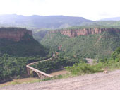 Ploetzlich
ging es bergauf, der Asphalt und der Regen stoppte und wir befanden
uns auf einer Hoehe von wo wir die Blue Nile Gorge uebersehen konnten,
unglaublich wie die Natur geformt ist. Ich glaube dies ist der Beginn
der Rift Valley, aber nicht sicher....Die Strasse wurde zum Pass und
fuehrte durch die Berge, sehr schoen! Dann ging es ueber die beruehmte
Blue Nile Bruecke, die man nicht photographieren darf, aber ich hab's
trotzdem geschafft (hab mich zu sehr geaergert in Kenia dass ich nichts
photographiert habe was ich eigentlich wollte!). Ploetzlich
ging es bergauf, der Asphalt und der Regen stoppte und wir befanden
uns auf einer Hoehe von wo wir die Blue Nile Gorge uebersehen konnten,
unglaublich wie die Natur geformt ist. Ich glaube dies ist der Beginn
der Rift Valley, aber nicht sicher....Die Strasse wurde zum Pass und
fuehrte durch die Berge, sehr schoen! Dann ging es ueber die beruehmte
Blue Nile Bruecke, die man nicht photographieren darf, aber ich hab's
trotzdem geschafft (hab mich zu sehr geaergert in Kenia dass ich nichts
photographiert habe was ich eigentlich wollte!).
Auf der anderen Seite ging es
wieder 2400m hoch durch die Berge. Dann im naechsten Ort wurde die Strasse
wieder Asphalt, einfach so ueber den weichen, mit Spurrillen versetzten
Black Cotton Soil uebergeteert, also nicht sehr gut. Es besserte sich
aber es wurde schon fast dunkel und wir konnten nirgendswo bushcampen
- ueberall waren Menschen! Ich hab einen Ort auf der Karte gesehen und
wir wollten es bis dahin schaffen und dann ist es passiert: In einem
Dorf sind wir ganz langsam in Schrittempo gefahren, Ziegen, Esel und
Menschen ueberall. Ein LKW kam uns auch langsam entgegen und als wir
Schnauze and Schnauze waren ist ein alter Mann dazwischen gedrungen
und wollte mit seinem Stock die Strasse ueberqueren. Wir haben keine
Hupe und fahren einen 3.5 T schweren Land Rover.....Ich hab nur geschrien
brems, brems aber die Kiste zum stehen zu bringen dauert eine weile,
es hat ein "donk" Geraeusch gemacht und der alte Mann war
nicht mehr da wo er vorher war. Wir kamen sofort 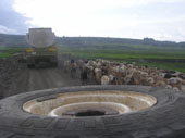 zum
Stehen und der LKW auch. Der Mann war auf der rechten Seite unter unserem
Bullfaenger aber noch vorm Reifen. Also haben wir ihn wenigstens nicht
ueberfahren! Oh war das Scheisse! Der arme Mann ist auf die Schulter
gefallen und hat einen Stoss von unserem Landy bekommen. Wir haben angehalten,
der LKW fahrer auch und sofort war eine Traube von Menschen um uns rum.
Der LKW-fahrer hat uns geholfen und gesagt wir sollen hoch zur Polizei
fahren. Wir wollten dem Mann Geld fuer's Hotel geben; er sass schon
wieder und war ok, hatte aber schmerzen. Bei der Polizei haben wir alles
erklaert und wollten wissen was zu tun war, aber die haben nur mit den
Schultern gezuckt und wussten nicht was sie machen sollten. Sofort kam
die ganze Menschenherde und wollte was von uns und haetten wahrscheinlich
das Geld aus unsereren Haenden gerissen. Jetzt mussten wir uns entscheiden
und leider was tun was wir hassten, aber es gab nur einen Weg raus....... zum
Stehen und der LKW auch. Der Mann war auf der rechten Seite unter unserem
Bullfaenger aber noch vorm Reifen. Also haben wir ihn wenigstens nicht
ueberfahren! Oh war das Scheisse! Der arme Mann ist auf die Schulter
gefallen und hat einen Stoss von unserem Landy bekommen. Wir haben angehalten,
der LKW fahrer auch und sofort war eine Traube von Menschen um uns rum.
Der LKW-fahrer hat uns geholfen und gesagt wir sollen hoch zur Polizei
fahren. Wir wollten dem Mann Geld fuer's Hotel geben; er sass schon
wieder und war ok, hatte aber schmerzen. Bei der Polizei haben wir alles
erklaert und wollten wissen was zu tun war, aber die haben nur mit den
Schultern gezuckt und wussten nicht was sie machen sollten. Sofort kam
die ganze Menschenherde und wollte was von uns und haetten wahrscheinlich
das Geld aus unsereren Haenden gerissen. Jetzt mussten wir uns entscheiden
und leider was tun was wir hassten, aber es gab nur einen Weg raus.......
Wir sind dann weiter gefahren
und haben uns ziemlich mies gefuehlt und der Mann tat uns nur leid!
David wollte sofort raus aus Aethiopien weil er sowas hasst - man will
helfen, alle lachen nur und sind mehr an uns interessiert als an ihren
eigenen Leuten, die verletzt da liegen und haetten das Geld einfach
so aus der Hand gerissen. Wir konnten nur hoffen, dass der LKW fahrer
da geblieben ist und dem Mann geholfen hat.....Trotzdem schrecklich!!
Wir sind langsam und stur weitergefahren
und haben in Marco Debres ein gutes Hotel gefunden, wo wir uns erstmal
entspannen mussten, das war vielleicht ein Schock und ziemlich aetzend!!!!
Where are
we: Bahar
Dar, Lake Tana, Ethiopia
Date: 31st - 1st
July 2005
End GPS: N11 35.875
E037 23.164
Total Kilometres: 66, 023km
Weather: Mixed bag
Camping: Ghion Hotel
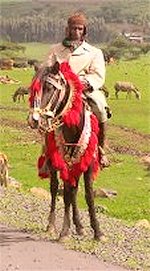 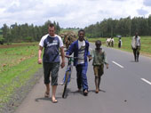 Another
day another stone thrown at the DuK, but this time revenge. As we drove
the tar road towards Bahar Dar the usual group of kids stood by the
road waving, Kat waved back and our spirits were high. The previous
days horror was fading and the road was good and the weather fine, but
cool. As we passed on group of kids the usual waving arms but then the
arm that isn't waving but instead throwing. Thwackkk!!!!! as the stone
made contact with the cars side. I slammed on the brakes and jumped
out as the kids bolted into the fields. To our great surprise a truck
had also stopped, having seen the kids throw the stones. The lorry driver
was nearer and quicker then either I or the kids and he had managed
to apprehend one of them. The little blighter was petrified and the
tears streaming from his eyes. The driver of the lorry apologised for
the child and explained that he would be taken to the local chief and
police and his parents would be reprimanded. It was amazing for us as
we really thought that nobody cared about the kids throwing stones at
us. Another
day another stone thrown at the DuK, but this time revenge. As we drove
the tar road towards Bahar Dar the usual group of kids stood by the
road waving, Kat waved back and our spirits were high. The previous
days horror was fading and the road was good and the weather fine, but
cool. As we passed on group of kids the usual waving arms but then the
arm that isn't waving but instead throwing. Thwackkk!!!!! as the stone
made contact with the cars side. I slammed on the brakes and jumped
out as the kids bolted into the fields. To our great surprise a truck
had also stopped, having seen the kids throw the stones. The lorry driver
was nearer and quicker then either I or the kids and he had managed
to apprehend one of them. The little blighter was petrified and the
tears streaming from his eyes. The driver of the lorry apologised for
the child and explained that he would be taken to the local chief and
police and his parents would be reprimanded. It was amazing for us as
we really thought that nobody cared about the kids throwing stones at
us.
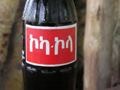 We
finally arrived in Bahar Dar set on the shores of lake Tana which is
Ethiopia largest lake fed by the waters of the Blue Nile. Bahir Dar
is also home to some of Ethiopia ancient monasteries and the Blue Nile
falls, known locally as Tis Abay or Waater that Smokes. The latter have
been somewhat tamed today by the building of a hydro damn, but at 400
metres wide and plunging 50 metres they are still worth a visit as they
lie just 30 km south of the town. Bahar Dar is a pleasant town and makes
a fine location to relax with none of the hassles of other Ethiopian
towns. We
finally arrived in Bahar Dar set on the shores of lake Tana which is
Ethiopia largest lake fed by the waters of the Blue Nile. Bahir Dar
is also home to some of Ethiopia ancient monasteries and the Blue Nile
falls, known locally as Tis Abay or Waater that Smokes. The latter have
been somewhat tamed today by the building of a hydro damn, but at 400
metres wide and plunging 50 metres they are still worth a visit as they
lie just 30 km south of the town. Bahar Dar is a pleasant town and makes
a fine location to relax with none of the hassles of other Ethiopian
towns.
Tagebuch
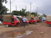 Heute
morgen war es kalt aber sonnig. Wir sind frueh losgefahren und haben
unterwegs viele Christen auf dem Weg zur Kirche, ganz in weissen Roben
gekleidet, gesehen. Alle anderen waren in gruen gekleidet und nicht
bei der Kirche....Mitten am Tag wurden wir schon wieder von Kindern
mit Steinen beschmissen, haben angehalten und ich bin hinterher gerannt.
Der LKW hinter uns hatte auch angehalten und kam auch schon mit einem
der Jungen am Ohr ziehend aus den Feldern. David hat mit ihm geredet
und der LKW Fahrer hat gesagt ein anderer Junge soll mit ihm zur Polizei.
Ich hab noch ein Photo von ihm gemacht um ihn so richtig abzuschrecken,
der hat ploetzlich geheult wie ein Baby - geschieht ihm recht! Ob die
wirklich zur Polizei gefahren sind wissen wir nicht und selbst wenn
machen die ja sowieso nichts, jedenfalls hat er sich etwas erschreckt
nicht einfach so damit davon gekommen zu sein! Dann haben wir noch einen
toten Esel gesehen mit drei Hunden mitten auf der Strasse die es sich
schmecken haben lassen - yuk! Heute
morgen war es kalt aber sonnig. Wir sind frueh losgefahren und haben
unterwegs viele Christen auf dem Weg zur Kirche, ganz in weissen Roben
gekleidet, gesehen. Alle anderen waren in gruen gekleidet und nicht
bei der Kirche....Mitten am Tag wurden wir schon wieder von Kindern
mit Steinen beschmissen, haben angehalten und ich bin hinterher gerannt.
Der LKW hinter uns hatte auch angehalten und kam auch schon mit einem
der Jungen am Ohr ziehend aus den Feldern. David hat mit ihm geredet
und der LKW Fahrer hat gesagt ein anderer Junge soll mit ihm zur Polizei.
Ich hab noch ein Photo von ihm gemacht um ihn so richtig abzuschrecken,
der hat ploetzlich geheult wie ein Baby - geschieht ihm recht! Ob die
wirklich zur Polizei gefahren sind wissen wir nicht und selbst wenn
machen die ja sowieso nichts, jedenfalls hat er sich etwas erschreckt
nicht einfach so damit davon gekommen zu sein! Dann haben wir noch einen
toten Esel gesehen mit drei Hunden mitten auf der Strasse die es sich
schmecken haben lassen - yuk!
 Um
13:00 Uhr sind wir in Bahir Dar angekommen, haben das Auto im Ghion
Hotel abgestellt und erst mal leckeren Kaffee getrunken. Das haben die
hier in Aethiopien echt gut drauf, Kaffee zu machen. Es gibt auch Kaffeezeremonien,
wo der Boden mit frischen Gras abgedeckt wird. Ein kleiner Grill steht
bereit, erst werden Raeucherstaebchen angezuendet und dann damit die
Kohlen worauf in einem schoenen Pott Kaffee frisch aufgebrueht wird
und dieser natuerlich mit viel Zucker, und manchmal Gewuerzen, sehr
stark getrunken wird. Um
13:00 Uhr sind wir in Bahir Dar angekommen, haben das Auto im Ghion
Hotel abgestellt und erst mal leckeren Kaffee getrunken. Das haben die
hier in Aethiopien echt gut drauf, Kaffee zu machen. Es gibt auch Kaffeezeremonien,
wo der Boden mit frischen Gras abgedeckt wird. Ein kleiner Grill steht
bereit, erst werden Raeucherstaebchen angezuendet und dann damit die
Kohlen worauf in einem schoenen Pott Kaffee frisch aufgebrueht wird
und dieser natuerlich mit viel Zucker, und manchmal Gewuerzen, sehr
stark getrunken wird.
Wir haben unsere Hupe und Scheibenwischer
repariert und sind im Ort und auf dem leeren Markt spazieren gegangen
bevor wir abends Chilli con Carne gekocht und uns das Treiben im Hotel
angeguckt haben.
Am naechsten Tag haben wir wieder
leckeren Kaffee zum Fruehstueck bestellt, der uns dann direkt auf die
Motorhaube von den netten Jungs 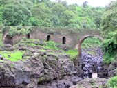 gestellt
wurde, cool! Dazu gab's Bananen und Mangos und dann haben wir uns die
Blue Nile Falls angeguckt. Ein guide wollte unbedingt mitkommen, obwohl
wir gesagt haben wir brauchen keinen und er hat gemeint, "no problem,
no problem, you don't have to give money!" Ja, dieses no problem,
no problem hat uns bis nach Aegypten verfolgt.....Als ich ihm am Ende
6 Birr als Trinkgeld geben wollte, hat er mich angeguckt und gesagt
ich muesste wenigstens 20 Birr geben - Arschgesicht!! Es hatte angefangen
wieder mal total zu regnen und fast wollte ich ihm die 6 auch wieder
aus der Hand reissen, aber somit haben wir ihn nur im Regen stehen gelassen..... gestellt
wurde, cool! Dazu gab's Bananen und Mangos und dann haben wir uns die
Blue Nile Falls angeguckt. Ein guide wollte unbedingt mitkommen, obwohl
wir gesagt haben wir brauchen keinen und er hat gemeint, "no problem,
no problem, you don't have to give money!" Ja, dieses no problem,
no problem hat uns bis nach Aegypten verfolgt.....Als ich ihm am Ende
6 Birr als Trinkgeld geben wollte, hat er mich angeguckt und gesagt
ich muesste wenigstens 20 Birr geben - Arschgesicht!! Es hatte angefangen
wieder mal total zu regnen und fast wollte ich ihm die 6 auch wieder
aus der Hand reissen, aber somit haben wir ihn nur im Regen stehen gelassen.....
Als wir wieder beim Hotel waren,
sind wir nach einem Kaffee zum Markt gegangen. Und mein Mann war shoppen!
Er, der mich immer wieder daran erinnert, dass wir nicht genug Platz
haben, hat sich schoen zwei Kugelsitze mit Kuhfell gekauft und ich mir
eine hiesige "lunchbox" (ein geflochtener Korb mit Kuhfell
ueberzogen). Aber er fand die so toll, war ganz gluecklich und meinte
immer bei Ikea und Habitat wuerden wir ein Vermoegen dafuer bezahlen
und fing auch noch mit no problem, no problem an und wollte Platz finden....hihihi
Somit haben wir schon wieder Sachen fuer ein Haus, oder Zuhause, was
wir gar nicht haben.....
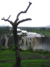

|